Gaugefechtsstand Wien
1940s in ViennaAerial bombingBuildings and structures in OttakringVienna WoodsWehrmacht ... and 2 more
World War II sites in AustriaWorld War II sites of Nazi Germany

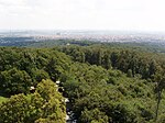
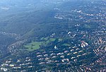
The Gaugefechtsstand Wien (regional combat command center Vienna) was a World War II subterranean command bunker situated in the densely forested Wienerwald western parts of Ottakring, the 16th district of Vienna. Commonly known as the Schirach-Bunker (named after the Nazi governor for the Reichsgau Wien, Baldur von Schirach), the facilities were constructed between 1942 and 1945 as a massive underground extension to barracks that had been established in 1940.
Excerpt from the Wikipedia article Gaugefechtsstand Wien (License: CC BY-SA 3.0, Authors, Images).Gaugefechtsstand Wien
Pelzer Rennweg, Vienna KG Ottakring (Ottakring)
Geographical coordinates (GPS) Address Nearby Places Show on map
Geographical coordinates (GPS)
| Latitude | Longitude |
|---|---|
| N 48.222222222222 ° | E 16.266944444444 ° |
Address
Wachbunker
Pelzer Rennweg
1160 Vienna, KG Ottakring (Ottakring)
Austria
Open on Google Maps


