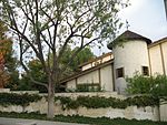
Rancho Las Vírgenes
1802 in Alta CaliforniaAgoura Hills, CaliforniaCalifornia ranchosConejo ValleyRanchos of Los Angeles County, California ... and 3 more
Santa Monica MountainsSimi HillsWestlake Village, California

Rancho Las Vírgenes was a 17,760-acre (71.9 km2) land grant in the Santa Monica Mountains and Simi Hills, in present day western Los Angeles County, California. The lands of the Rancho Las Vírgenes included present day Agoura Hills, Oak Park, and Westlake Village and part of the Santa Monica Mountains.It was given in 1802 by Spanish Governor José Joaquín de Arrillaga to Miguel Ortega, but was abandoned after his death in 1809. Nemecio Domínguez and Domingo Carrillo received a Mexican land grant in 1834. Nuestra Señora la Reina de las Vírgenes translates as "Our Lady the Queen of the Virgins".
Excerpt from the Wikipedia article Rancho Las Vírgenes (License: CC BY-SA 3.0, Authors, Images).Rancho Las Vírgenes
Russell Ranch Road,
Geographical coordinates (GPS) Address Nearby Places Show on map
Geographical coordinates (GPS)
| Latitude | Longitude |
|---|---|
| N 34.15 ° | E -118.8 ° |
Address
Russell Ranch Road 30998
91362
California, United States
Open on Google Maps


