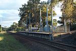
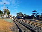
Langwarrin South, Victoria
Melbourne geography stubsTowns in Victoria (state)Use Australian English from August 2019
Langwarrin South is an official bounded locality in Melbourne, Victoria, Australia, 47 km south-east of Melbourne's Central Business District, located within the City of Frankston local government area. Langwarrin South recorded a population of 1,346 at the 2021 census.Langwarrin South is bounded in the north by Robinsons Road, in the east by Dandenong-Hastings Road, in the south by Golf Links and Baxter-Tooradin Roads and in the west by the route of the proposed extension of the Mornington Peninsula Freeway.
Excerpt from the Wikipedia article Langwarrin South, Victoria (License: CC BY-SA 3.0, Authors).Langwarrin South, Victoria
Newton Avenue, Melbourne Langwarrin South
Geographical coordinates (GPS) Address Nearby Places Show on map
Geographical coordinates (GPS)
| Latitude | Longitude |
|---|---|
| N -38.189 ° | E 145.189 ° |
Address
Newton Avenue
Newton Avenue
3911 Melbourne, Langwarrin South
Victoria, Australia
Open on Google Maps


