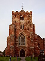
Petton, Shropshire
Civil parishes in ShropshireShropshire geography stubsVillages in Shropshire

Petton is a small village and civil parish in Shropshire, England. It was mentioned in Domesday as "Peetone", a name probably derived from Old English paec-tun, "settlement by the hill".Petton is near to the village and parish of Cockshutt, south-east of the town Ellesmere. The two parishes have in recent years combined their parish councils under the name Cockshutt-cum-Petton.
Excerpt from the Wikipedia article Petton, Shropshire (License: CC BY-SA 3.0, Authors, Images).Petton, Shropshire
A528,
Geographical coordinates (GPS) Address Nearby Places Show on map
Geographical coordinates (GPS)
| Latitude | Longitude |
|---|---|
| N 52.835 ° | E -2.834 ° |
Address
A528
SY4 3RA , Myddle and Broughton
England, United Kingdom
Open on Google Maps


