place

Ten Mile Creek Bridge (Oregon)

1931 establishments in OregonArt Deco architecture in OregonBridges by Conde McCulloughBridges completed in 1931Bridges in Lane County, Oregon
Bridges of the United States Numbered Highway SystemConcrete bridges in the United StatesHistoric American Engineering Record in OregonNational Register of Historic Places in Lane County, OregonNeoclassical architecture in OregonOregon Registered Historic Place stubsOregon building and structure stubsOregon transportation stubsRoad bridges on the National Register of Historic Places in OregonTied arch bridges in the United StatesU.S. Route 101Use mdy dates from August 2023Western United States bridge (structure) stubs
Ten Mile Creek Bridge

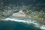
Ten Mile Creek Bridge (No. 01181) is a Conde McCullough-designed bridge near Yachats in Lane County in the U.S. state of Oregon. It was listed on the National Register of Historic Places in 2005.The bridge carries U.S. Route 101 over Tenmile Creek. McCullough designed the structure in 1931. Built of reinforced concrete through a tied arch, the total length of the bridge is 180 feet (55 m) with a main span of 120 feet (37 m). Ornate precast concrete railings run along the sides.

Excerpt from the Wikipedia article Ten Mile Creek Bridge (Oregon) (License: CC BY-SA 3.0, Authors, Images).

Ten Mile Creek Bridge (Oregon)
Oregon Coast Highway,

Geographical coordinates (GPS) Address External links Nearby Places
placeShow on map

Wikipedia: Ten Mile Creek Bridge (Oregon)Continue reading on Wikipedia

Geographical coordinates (GPS)

Latitude Longitude
N 44.2241 ° E -124.10959 °
placeShow on map

Address

Oregon Coast Highway

Oregon Coast Highway

Oregon, United States
mapOpen on Google Maps

linkWikiData (Q7699234)
linkOpenStreetMap (34954152)

Ten Mile Creek Bridge
Share experience

Nearby Places

Cleft of the Rock Light

Cleft of the Rock Light is a privately owned lighthouse located on the Pacific coast of the U.S. state of Oregon, 1.8 miles (2.9 km) south of Yachats on Cape Perpetua.It was built, in 1976, by former Tillamook Rock Light attendant and lighthouse historian James A. Gibbs who was active in preserving the lantern room of Smith Island Light. Cleft of the Rock Light is designed after Fiddle Reef Light, which operated from 1898 to 1958 in Oak Bay, British Columbia, a suburb of Victoria, British Columbia, Canada. The Cleft's tower contains a stair railing from the original keeper's dwelling at Yaquina Head Light. Other historic items include a stopwatch from Desdemona Sands Light, two brass oil cans from Tillamook Rock Light and Heceta Head Light, and a crank handle which wound the weights at Point Sur Light. It also has two fourth order Fresnel lenses. The Coast Guard made it an official navigational marker in 1979.The lighthouse is part of Gibbs' home, which also houses a private museum. The grounds and tower are closed to the public, however they are visible from U.S. Route 101 near mile marker 166. It is just outside the northwest corner of the Cape Perpetua National Scenic Area. Gibbs died at home on 30 April 2010. His daughter and son-in-law—who lived at the property for 27 years with Gibbs—intended to maintain the lighthouse as an official aid to navigation. The facility is still closed to the public. Cleft of the Rock is named after Fanny Crosby's hymn He Hideth My Soul in the Cleft of the Rock, which is based on Exodus 33:22.