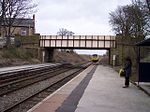
Skelmersdale
Geography of the Borough of West LancashireNew towns in EnglandNew towns started in the 1960sSkelmersdaleTowns in Lancashire ... and 2 more
Unparished areas in LancashireUse British English from November 2011

Skelmersdale is a town in Lancashire, England, on the River Tawd, 6 miles (10 km) west of Wigan, 13 miles (21 km) northeast of Liverpool and 15 miles (24 km) southwest of Preston. In 2006, it had a population of 38,813. The town is known locally as Skem . While the first record of the town is in the Domesday Book of 1086, much of the town, including the current town centre, was developed as a second wave new town in the 1960s. The town's initial development as a coal town coincided with the Industrial Revolution in the 19th century; the town lies on the Lancashire Coalfield.
Excerpt from the Wikipedia article Skelmersdale (License: CC BY-SA 3.0, Authors, Images).Skelmersdale
Yeadon, West Lancashire Town Centre
Geographical coordinates (GPS) Address Nearby Places Show on map
Geographical coordinates (GPS)
| Latitude | Longitude |
|---|---|
| N 53.55 ° | E -2.776 ° |
Address
West Lancs Youth Zone
Yeadon
WN8 6LT West Lancashire, Town Centre
England, United Kingdom
Open on Google Maps


