place

Portland Island (British Columbia)

British Columbia Coast geography stubsIslands of the Gulf IslandsUse Canadian English from January 2023
Portland Island, BC
Portland Island, BC

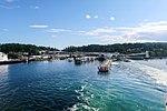
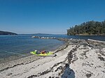
Portland Island is an island of the Southern Gulf Islands of the South Coast of British Columbia, Canada. It is located in the Salish Sea west of Moresby Island and off the south tip of Saltspring Island, adjacent to the main BC Ferries route just offshore from the terminal at Swartz Bay at the tip of the Saanich Peninsula. It was named after HMS Portland, the flagship of Rear-Admiral Fairfax Moresby, Commander in Chief of the Pacific Station 1850–1853.: 214 Portland Island is separated from North Pender Island to the northeast by Swanson Passage, Moresby Island by Moresby Passage to the east, Piers Island and Coal Island to the southeast by Shute Passage, and Saltspring Island to the west and north by Satellite Channel. Portland Island was given to Princess Margaret in 1958 to commemorate her visit to the province. Princess Margaret returned the island to British Columbia in 1967, following which it became a provincial park. Today, Portland Island is a part of Gulf Islands National Park Reserve (GINPR).

Excerpt from the Wikipedia article Portland Island (British Columbia) (License: CC BY-SA 3.0, Authors, Images).

Portland Island (British Columbia)
Stevens Road, Salt Spring Island Electoral Area

Geographical coordinates (GPS) Address Nearby Places
placeShow on map

Wikipedia: Portland Island (British Columbia)Continue reading on Wikipedia

Geographical coordinates (GPS)

Latitude Longitude
N 48.733333333333 ° E -123.36666666667 °
placeShow on map

Address

Stevens Road
V8K 1Y3 Salt Spring Island Electoral Area
British Columbia, Canada
mapOpen on Google Maps

Portland Island, BC
Portland Island, BC
Share experience

Nearby Places

Moresby Island (Gulf Islands)

Moresby Island is one of the Gulf Islands of British Columbia, located on the west side of Swanson Channel and east of the southern end of Saltspring Island. It is not to be confused with Moresby Island, the second largest of the Haida Gwaii Islands off the north coast of BC. It is currently a privately owned island, and is used by its current owners to raise beef cattle. The island is not open to the general public. Its current population is 2 people, a manager and his wife. Moresby Island has an elevation of 148 meters (485 feet 6 inches) above sea level at its highest point, and has a total land area of 3.22 sq. miles. The island is 3.7 km (2.3 mi) in length, and is 2.2 km (1.4 mi) across.: 9  The island was first settled in 1863. It was named for Rear Admiral Fairfax Moresby, who was the naval commander-in-chief of the Pacific Station of the Royal Navy between 1850 and 1853, as was Fairfax Point at the island's southern tip: 342  and the other Moresby Island in Haida Gwaii. During the 1880s, land was cleared by Capt. H. J. Robertson, then owner, in order to plant fruit trees. In 1940, the island again changed hands.The island has been logged three times by separate Chinese logging companies. The evidence of this logging is nearly gone, yet there are a few signs of logging still remaining. Traces of the trails built for the machines can still be found. It has a very rich history, including a ghost story, the remains of a long-gone mansion, and evidence of First Nations people using the island as a resting place when traveling. Moresby Island