Rancho Las Bolsas
1834 establishments in Alta CaliforniaCalifornia ranchosGeography of Garden Grove, CaliforniaGeography of Huntington Beach, CaliforniaHistory of Huntington Beach, California ... and 1 more
Ranchos of Orange County, California

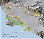
Rancho Las Bolsas was a 33,460-acre (135.4 km2) 1834 Mexican land grant resulting from the partition of Rancho Los Nietos, located from the coast on inland within present day northwestern Orange County, California. The Spanish name "las bolsas" means "the pockets", and refers to pockets of land amongst the marsh wetlands of the Santa Ana River estuary. The rancho lands, adjacent to the southeast of Rancho La Bolsa Chica, include the present day cities of Huntington Beach, Garden Grove, Fountain Valley and Westminster.
Excerpt from the Wikipedia article Rancho Las Bolsas (License: CC BY-SA 3.0, Authors, Images).Rancho Las Bolsas
Ocean Terrace Drive, Huntington Beach
Geographical coordinates (GPS) Address Nearby Places Show on map
Geographical coordinates (GPS)
| Latitude | Longitude |
|---|---|
| N 33.69 ° | E -118.03 ° |
Address
Ocean Terrace Drive
92648 Huntington Beach
California, United States
Open on Google Maps


