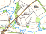
place

Patney

Civil parishes in WiltshireEngvarB from August 2019Pages containing London Gazette template with parameter supp set to yVillages in Wiltshire
Patney geograph.org.uk 1742375

Patney is a small village and civil parish in Wiltshire, England, in the Vale of Pewsey about 4.5 miles (7.2 km) south-east of Devizes. The infant Salisbury Avon forms part of the southern boundary of the parish.

Excerpt from the Wikipedia article Patney (License: CC BY-SA 3.0, Authors, Images).

Geographical coordinates (GPS)

Latitude Longitude
N 51.325 ° E -1.898 °
placeShow on map

Address

Woodland Road
SN10 3QZ , Patney
England, United Kingdom
mapOpen on Google Maps

Patney geograph.org.uk 1742375
Share experience

Nearby Places

Wiltshire
Wiltshire

Wiltshire (; abbreviated to Wilts) is a ceremonial county and historic county in South West England. It borders Gloucestershire to the north and the north-west, Oxfordshire to the north-east, Berkshire to the east, Hampshire to the south-east, Dorset to the south, and Somerset to the west and the south-west. The largest settlement is Swindon, and Trowbridge is the county town. The county has an area of 1,346 sq mi (3,490 km2) and a population of 720,060. The county is mostly rural, with the centre and south-west sparsely populated. After Swindon (183,638), the largest settlements are the city of Salisbury (41,820) and the towns of Chippenham (37,548) and Trowbridge (37,169). For local government purposes the county comprises two unitary authority areas: Swindon and Wiltshire. Undulating chalk downlands characterize much of the county; the North Wessex Downs in the east, Salisbury Plain in the centre and Cranbourne Chase in the south. The north-west is part of the Cotswolds, a limestone area. The county's major rivers are both called the Avon: the northern Avon enters the county in the north-west and flows in a southwesterly direction before leaving it near Bradford-on-Avon; the southern Avon rises on Salisbury Plain, flows through Salisbury and then into Hampshire. Salisbury Plain is noted for the Stonehenge and Avebury stone circles, which together are a UNESCO World Heritage Site, and other ancient landmarks. Much of the plain is a training area for the British Army. The city of Salisbury is notable for its medieval cathedral. Large country houses open to the public include Longleat, where there is also a safari park, and the National Trust's Stourhead.

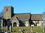
All Cannings Cross
All Cannings Cross

All Cannings Cross is the name of farm and an archaeological site close to All Cannings, near Devizes in the English county of Wiltshire. The site is a scheduled ancient monument.It is notable as the first site where the emergence of Iron Age technology in Britain was identified by archaeologists. In 1911 it was first investigated by Ben and Maud Cunnington after they were informed of finds of numerous hammerstones in a ploughed field in the Vale of Pewsey. Subsequent excavation by the Cunningtons encountered a thick layer of humic material containing a high concentration of pottery and animal bone as well as both bronze and iron tools. The date of the site was estimated at c. 500 BC, a time of transition from the Bronze Age to the Iron Age. The Cunningtons returned to the site between 1920 and 1922, and study of the wide range of pottery they excavated became influential on the understanding of the period. From the eighth century to the seventh century BC, the area (Wessex) boasted an elaborate array of different vessel types, often highly decorated and well made. Some were covered with iron oxide and fired in oxidising conditions which produced pottery which could be burnished to shine like bronze vessels. This pottery, which has All Cannings Cross as its typesite, has since been found in an area of southern Britain from the Somerset Levels to eastern Hampshire. This suggests a high degree of interaction during the period and some kind of shared values which indicate that communities in the region were in close contact with another, likely through exchange networks used to trade bronze. There is evidence for some post-built buildings and other settlement features such as hearths and floors. More recent work by the University of Sheffield in 2003 and 2004 has interpreted the humic deposit as being part of a group of large middens, analogous to similar sites at nearby Potterne or East Chisenbury. The nature of the settlement itself is still poorly understood and it is uncertain whether the middens represent waste materials from a farming economy of whether the midden pits were perhaps ritually created through group feasting activities.