place

Winster

Civil parishes in DerbyshireDerbyshire DalesTowns and villages of the Peak DistrictVillages in Derbyshire
Winster 028530 9c349def

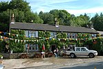
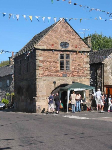
Winster is a village in the English Derbyshire Dales about 5 miles (8 km) from Matlock and 6 miles (10 km) from Bakewell at an altitude of approximately 820 feet (250 m). It was formerly a centre for the lead mining industry. The village lies within the Peak District National Park and The Peak District Boundary Walk runs through the village. Winster has many listed buildings, including the Market House open daily as a National Trust information point. The 2021 census shows a population of 551, down from 633 in 2001 and 600 in 2011. The village has a primary school, two churches, two pubs, a village hall (The Burton Institute) and a village shop (owned by the community) which includes a post office. Winster was mentioned in the Domesday Book in 1086 when it was owned by Henry de Ferrers.A workhouse at Bank Top (grid reference SK239602) was opened in 1744. It had a rule that forbade any relief outside of the workhouse. By the 1770s it could house 40 inmates.Winster Market House was the National Trust's first property in the Peak District and was acquired in 1906.

Excerpt from the Wikipedia article Winster (License: CC BY-SA 3.0, Authors, Images).

Winster
Schulstraße, Düsseldorf Carlstadt (Stadtbezirk 1)

Geographical coordinates (GPS) Address Nearby Places
placeShow on map

Wikipedia: WinsterContinue reading on Wikipedia

Geographical coordinates (GPS)

Latitude Longitude
N 53.1419 ° E -1.6399 °
placeShow on map

Address

Palais Nesselrode

Schulstraße 4
40213 Düsseldorf, Carlstadt (Stadtbezirk 1)
Nordrhein-Westfalen, Deutschland
mapOpen on Google Maps

Winster 028530 9c349def
Share experience

Nearby Places

Doll Tor
Doll Tor

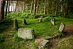
Doll Tor is a stone circle located just to the west of Stanton Moor, near the village of Birchover, Derbyshire in the English East Midlands. Doll Tor is part of a tradition of stone circle construction that spread throughout much of Britain, Ireland, and Brittany during the Late Neolithic and Early Bronze Ages, over a period between 3300 and 900 BCE. The purpose of such monuments is unknown, although archaeologists speculate that the stones represented supernatural entities for the circles' builders. With a diameter of 7 metres, Doll Tor consists of six upright main stones arranged in a circle. Drystone walling consisting of smaller, flat stones was packed between these orthostats. A stone cairn had been added to the east of the circle, perhaps in a second phase of construction. Excavation has revealed that the cremated human remains of several adults and children were buried both within the circle and around the cairn. These remains were often though not always placed in ceramic urns, and were sometimes deposited alongside other material such as flint tools, small pieces of bronze, and faience beads. The antiquarian Thomas Bateman excavated at the site in 1852, and J. P. Heathcote conducted a second excavation between 1931 and 1933. By the early 21st century, the site was being used for ritual activity by modern Pagans. Unknown persons damaged the site in 1993 and 2020 by moving various stones around; they were subsequently returned to their original locations.