place

Hafod Garregog National Nature Reserve

National nature reserves in WalesWales geography stubs

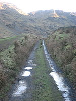
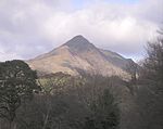
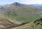
Hafod Garegog National Nature Reserve is a national nature reserve located near the village of Nantmor, about 6 kilometres north of Porthmadog in Gwynedd. In this reserve, peaty hollows run between three parallel ridges of woodland-covered rock. Fine views can be enjoyed in all directions, with Snowdon and the Aberglaslyn pass providing a stunning landscape to the north, whilst the Moelwyn range fills the skyline to the east. To the south, the broad valley of the River Glaslyn rolls out towards the sea.

Excerpt from the Wikipedia article Hafod Garregog National Nature Reserve (License: CC BY-SA 3.0, Authors).

Hafod Garregog National Nature Reserve
Former Croesor Tramway,

Geographical coordinates (GPS) Address Nearby Places
placeShow on map

Wikipedia: Hafod Garregog National Nature ReserveContinue reading on Wikipedia

Geographical coordinates (GPS)

Latitude Longitude
N 52.987 ° E -4.03 °
placeShow on map

Address

Former Croesor Tramway

Former Croesor Tramway
LL48 6SS , Llanfrothen
Wales, United Kingdom
mapOpen on Google Maps

Share experience

Nearby Places

Yr Arddu (South)
Yr Arddu (South)

Yr Arddu is a large hill in Snowdonia, Wales (Not to be confused with the 589 metre Yr Arddu (North) to the east of Snowdon). It lies approximately 2.5 km south east of the village of Beddgelert and just over 1 km from the rather more famous mountain Cnicht. It is a rugged hill with widespread rock outcrops and cliffs. A small lake, Llyn yr Arddu, is located on the flanks of the mountain. The recognised summit is at 388m to the South of the hill, but the highest point, named Cerrig-y-Myllt on only the most detailed UK Ordnance Survey mapping, is at 463m above the two small lakes to the North of the hill. The craggy nature of the hill is due to the presence of lavas and tuffs (volcanic ash deposits) dating from the Ordovician period when Snowdonia was characterised by numerous volcanic eruptions; Yr Arddu is a particularly good location to see the record of Ordovician volcanism. The Yr Arddu Tuffs may be the earliest eruptive phase of the Lower Rhyolitic Tuff Formation.The whole hill is a site of special scientific interest designated by the Countryside Council for Wales.Yr Arddu is commonly approached by a footpath leaving the minor road that links Nantmor to Nant Gwynant running along the valley of Blaen Nanmor, but the final 0.5 km has no paths marked on UK Ordnance Survey mapping. However, a marked path runs South East from Nantmor Mountain Centre at Gelli-Iago. From this an intermittent rough path runs from West of Clogwyn Coch up to the two small lakes. The hill can also be approached with more difficulty from its West flank up to the small lake Llyn yr Arddu.

Croesor quarry
Croesor quarry

Croesor quarry is a large underground slate mine in North Wales which was served by Croesor Tramway. Small scale quarrying began in the 1846, and by 1861, there were two companies in operation. They amalgamated in 1865, a year after the quarry was connected to the newly opened Croesor Tramway. Much money was invested in development work, but volumes of useful slate produced were small, amounting to just 226 tons in 1868. Access to the underground workings was by a single adit, and the surface mill was powered by two water wheels. A change of ownership in 1875 did little to improve the profitability of the quarry, and it closed in 1878 or 1882. In 1895, the quarry reopened under the direction of Moses Kellow, a fearless innovator who set about modernising working practices and methods. The two-man teams working in the mill were no longer tied to a two-man team working underground, which enabled the mill to operate more efficiently. Following trials with air drills, he decided instead to electrify the mill, building a large hydro-electric station, which generated three-phase alternating current, rather than the direct current recommended by British manufacturers. He obtained motors from Prague, which were used to drive winches and an electric locomotive, the first to work in Wales. The water wheels were supplemented by Pelton wheels, supplied by Gilbert Gilkes of Kendal. His greatest innovation was the Kellow drill, a hydraulic drill for which he obtained six patents between 1898 and 1915. It could drill a 7.5-foot (2.3 m) hole in the slate in under two minutes, much less than the day required using hand drills. The mine was ventilated by a Guibal fan, housed in a fan-house near the entrance to the adit. Peak output under Kellow's direction was between 5,000 and 6,000 tons per year, though it declined in the later years, until the quarry closed in 1930. The chambers were used by Cookes Explosives to store propellants from the late 1940s until the early 1970s. This ceased when the Central Electricity Generating Board became aware of it, and feared that an underground explosion would damage the dams of the Ffestiniog pumped storage power station. Both lakes were drained until the explosives had been removed. The quarry was worked on seven levels, but the three below the adit level are now flooded. There was an underground link to the nearby Rhosydd quarry, and the "Croesor Rhosydd Through Trip" is a well known, if somewhat dangerous, route for mine explorers.