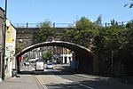
Stapleton Road railway station

Stapleton Road railway station is on the Severn Beach Line and Cross Country Route, serving the inner-city district of Easton in Bristol, England. It is 1.6 miles (2.6 km) from Bristol Temple Meads. Its three letter station code is SRD. The station has two platforms, four running lines and minimal facilities. It is managed by Great Western Railway, the seventh company to be responsible for the station, and the third franchise since privatisation in 1997. They provide all train services at the station, the standard service being two trains per hour along the Severn Beach Line and an hourly service between Bristol Temple Meads and Filton Abbey Wood. The station was opened in 1863 by the Bristol and South Wales Union Railway, with a single track and platform. The line was doubled in 1874 when the Clifton Extension Railway opened, then expanded to four tracks and platforms in 1888. There were buildings on all platforms and a goods yard to the north. Stapleton Road became one of Bristol's busiest stations, but service levels reduced significantly in the 1960s when reversing trains at Bristol Temple Meads became common. The goods facilities were closed in 1965, staff were withdrawn in 1967 and the line was reduced to two tracks in 1984. In 2018, two additional running lines were added to increase capacity as part of the 21st-century modernisation of the Great Western Main Line. The line was also due to be electrified, but this has now been deferred until the next control period, which runs from 2019 to 2024.
Excerpt from the Wikipedia article Stapleton Road railway station (License: CC BY-SA 3.0, Authors, Images).Stapleton Road railway station
Saint Marks Grove, Bristol Easton
Geographical coordinates (GPS) Address Nearby Places Show on map
Geographical coordinates (GPS)
| Latitude | Longitude |
|---|---|
| N 51.4675 ° | E -2.5661 ° |
Address
Platform 2
Saint Marks Grove
BS5 0LJ Bristol, Easton
England, United Kingdom
Open on Google Maps


