Lower Withington
Cheshire geography stubsCivil parishes in CheshireVillages in Cheshire

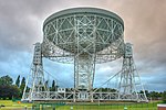
Lower Withington is a civil parish and village in Cheshire, England. At the 2001 census, it had a population of 492. Jodrell Bank Observatory lies mostly within the parish. It is on the B5392 near the A535 road, 11 kilometres (7 mi) south-west of Macclesfield and 29 kilometres (18 mi) south of Manchester.
Excerpt from the Wikipedia article Lower Withington (License: CC BY-SA 3.0, Authors, Images).Lower Withington
Salters Lane,
Geographical coordinates (GPS) Address Nearby Places Show on map
Geographical coordinates (GPS)
| Latitude | Longitude |
|---|---|
| N 53.224 ° | E -2.279 ° |
Address
Salters Lane
Salters Lane
SK11 9DZ , Lower Withington
England, United Kingdom
Open on Google Maps


