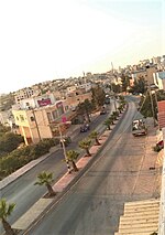
Tarrama
Hebron GovernorateVillages in the West Bank
Tarrama (Arabic: طرّامة, also known as Khirbet al-Tarramah) is a Palestinian village situated on a hilltop with an elevation of 879 meters (2,884 ft) in the southern West Bank, part of the Hebron Governorate. Located just south of Dura, nearby localities include at-Tabaqa to the north, Fawwar to the east, Khursa to the west, and Deir Razih to the south. The village had a population of 642 in 2017. Its total land area is 210 dunams and the village is provided with electricity and telephone lines.
Excerpt from the Wikipedia article Tarrama (License: CC BY-SA 3.0, Authors).Tarrama
Geographical coordinates (GPS) Address Nearby Places Show on map
Geographical coordinates (GPS)
| Latitude | Longitude |
|---|---|
| N 31.480833333333 ° | E 35.0325 ° |
Address
Palestinian Territories
Open on Google Maps


