place

Coquitlam Mountain

British Columbia Coast geography stubsLandforms of CoquitlamNew Westminster Land DistrictOne-thousanders of British ColumbiaPacific Ranges
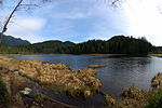
View from Burke Mountain

Coquitlam Mountain is a mountain located in northeast Coquitlam, British Columbia, 6.2 km (3.9 mi) east of Coquitlam Lake and 9.7 km (6.0 mi) north of Minnekhada Regional Park. The mountain is located at the head of Or Creek, completely within the Coquitlam watershed, and thus public access is forbidden by law. Mount Burke forms the southern ridge of Coquitlam Mountain.The first recorded ascent of the mountain was in 1918 by P. James and D. Munday. The mountain's name was adopted on 3 May 1951, in association with the Coquitlam River.

Excerpt from the Wikipedia article Coquitlam Mountain (License: CC BY-SA 3.0, Authors, Images).

Coquitlam Mountain
Electoral Area A

Geographical coordinates (GPS) Address Nearby Places
placeShow on map

Wikipedia: Coquitlam MountainContinue reading on Wikipedia

Geographical coordinates (GPS)

Latitude Longitude
N 49.392777777778 ° E -122.70694444444 °
placeShow on map

Address

Electoral Area A


Electoral Area A
British Columbia, Canada
mapOpen on Google Maps

View from Burke Mountain
Share experience

Nearby Places

Minnekhada Regional Park

Minnekhada Regional Park is a natural park situated in northeast Coquitlam, British Columbia, alongside Pitt-Addington Marsh and the Pitt River. It is over 200 hectares in size, and features trails, rock knolls, abundant trees, birds and other wildlife. At the centre of the park is the main marsh area, divided into upper and lower sections, divided by a dike and small footbridge. There are two main entrances to the park with parking facilities. The Quarry Road entrance serves as the primary trail access point for hikers and bird watchers. The Oliver Road entrance provides access to Minnekhada Lodge, as well as access to some of the trails. There is a secondary entrance in the northwest corner of the park, further north of the Quarry Road entrance, but there is no parking at this location. There are three primary trails through the park that follow an eastern trajectory towards the Pitt-Addington Marsh boundary: Quarry Trail Mid-Marsh Trail Lodge/Fern TrailsThere are five lookout points in the park. Of these, Low Knoll with its full view of the lower marsh, and High Knoll with its 600 ft (180 m). elevation and view of the Pitt River and Pitt Meadows beyond, are among the most popular. A full perimeter trail hike through Quarry Trail, Fern Trail, and Lodge Trail covers a distance of 5.2 km (this does not include excursions to lookout points such as High Knoll and Low Knoll). Minnekhada Regional Park is a designated Wildlife Watch site.