Point Lobos Ranch
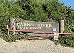
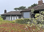
Point Lobos Ranch is an 1,315-acre (532 ha) parcel of land owned by the state of California in the northern region of Big Sur, California, United States. San Jose Creek on the ranch was the site of an Ohlone village for thousands of years. Europeans first visited the site when the Portolá expedition camped at the site for 10 days in the winter of 1769. Point Lobos Ranch is located south of Carmel-by-the-Sea and east of Point Lobos State Reserve. It contains one of the world's largest stands of native Monterey pines, endangered Gowen cypress, and rare maritime chaparral plant communities. It was acquired by California State Parks in 2001 but is not accessible to the public. The agency has stated that the land is being held for possible use as a state park.
Excerpt from the Wikipedia article Point Lobos Ranch (License: CC BY-SA 3.0, Authors).Point Lobos Ranch
Cabrillo Highway,
Geographical coordinates (GPS) Address Website Nearby Places Show on map
Geographical coordinates (GPS)
| Latitude | Longitude |
|---|---|
| N 36.517694444444 ° | E -121.94711111111 ° |
Address
Point Lobos State Natural Reserve
Cabrillo Highway
93922
California, United States
Open on Google Maps


