place

Delray, Detroit

1836 establishments in Michigan TerritoryFormer villages in MichiganHungarian-American culture in MichiganMichigan populated places on the Detroit RiverNeighborhoods in Detroit
Populated places established in 1836Urban decay in the United StatesUse American English from October 2021Use mdy dates from October 2021
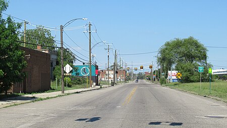
Delray, Detroit (June 2021)

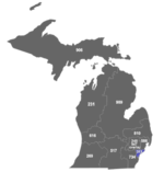
Delray is a neighborhood in southwest Detroit in the U.S. state of Michigan. Its area extends south to the River Rouge, east to the Detroit River, west to Fort Street, and north to Clark Street. The two census tracts that cover the neighborhood had a population of 2,783 at the 2010 census. Delray was platted in 1836. Initially a rural area, heavy industry arrived in the 1890s, beginning a prosperous era leading to Delray incorporating as a village in 1897. Delray's population swelled, fueled largely by immigrants from Eastern Europe, and the village's 7 square miles (18 km2) were annexed into the city of Detroit in 1906. By 1930, Delray peaked at approximately 24,000 residents, but the population has dropped precipitously since World War II due to increased industrialization, pollution, and urban decay. By the late 1960s, the city's master plan for Delray was to transition it to a purely industrial area. In 2007, the Detroit Metro Times described Delray as "the closest thing to a ghost town within a city."In 2013, Delray was selected for the location of the upcoming Gordie Howe International Bridge. The enormous project will radically alter the neighborhood and result in the destruction of numerous structures and roadways, as well as the relocation of some residents.

Excerpt from the Wikipedia article Delray, Detroit (License: CC BY-SA 3.0, Authors, Images).

Delray, Detroit
Melville Street, Detroit

Geographical coordinates (GPS) Address Nearby Places
placeShow on map

Wikipedia: Delray, DetroitContinue reading on Wikipedia

Geographical coordinates (GPS)

Latitude Longitude
N 42.295833333333 ° E -83.116666666667 °
placeShow on map

Address

Melville Street 8039
48209 Detroit
Michigan, United States
mapOpen on Google Maps

Delray, Detroit (June 2021)
Share experience

Nearby Places

River Rouge (Michigan)

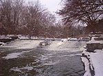
The River Rouge is a 127-mile (204 kilometer) river in the Metro Detroit area of southeastern Michigan. It flows into the Detroit River at Zug Island, which is the boundary between the cities of River Rouge and Detroit. The river's roughly 467-square-mile (1,210 km2) watershed includes all or parts of 48 municipalities, with a total population of more than 1.35 million, and it drains a large portion of central and northwest Wayne County, as well as much of southern Oakland County and a small area in eastern Washtenaw County. Nearly the entire drainage basin is in urban and suburban areas, with areas of intensive residential and industrial development. Still, more than 50 miles (80 km) of the River Rouge flow through public lands, making it one of the most accessible rivers in the state. Until recently the river was heavily polluted, and in 1969 oil on the surface caught fire. The passage of the Clean Water Act in 1972 made it unlawful to discharge any pollution from a point source into navigable waters, and the EPA's National Pollution Discharge Elimination Program was created to regulate these discharges. In 1986, a non-profit organization of concerned citizens called Friends of the Rouge was formed and began organizing an annual cleanup called Rouge Rescue, to raise awareness about the need to clean up the Rouge. In 1987, the entire watershed was designated a Great Lakes "area of concern" under the Great Lakes Water Quality Agreement.In 1992, a massive project called the Rouge River National Wet Weather Demonstration Project was implemented, and further cleanup measures are ongoing. The Alliance of Rouge Communities is an organization of governmental and non-governmental entities created in 2006 to manage the watershed.