place

David Jay Perry Airport

Airports in OklahomaBuildings and structures in McClain County, OklahomaOklahoma building and structure stubsSouthern United States airport stubs

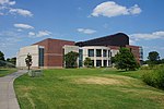
David Jay Perry Airport is a town-owned public-use airport in Goldsby, a town in McClain County, Oklahoma, United States. The airport is located near the interchange of I-35 and State Highway 74. The airport was originally built by the US Navy in 1943 as an octagonal-shaped Outlying Landing Field serving Naval Air Station Norman, OK, six miles to the north. After the war, ownership of the field was transferred to the city of Goldsby, undergoing several improvements and expansions over the following decades.

Excerpt from the Wikipedia article David Jay Perry Airport (License: CC BY-SA 3.0, Authors).

David Jay Perry Airport
World War I Veterans Memorial Highway,

Geographical coordinates (GPS) Address External links Nearby Places
placeShow on map

Wikipedia: David Jay Perry AirportContinue reading on Wikipedia

Geographical coordinates (GPS)

Latitude Longitude
N 35.1550675 ° E -97.470393888889 °
placeShow on map

Address

David Jay Perry Airport

World War I Veterans Memorial Highway
73093
Oklahoma, United States
mapOpen on Google Maps

linkWikiData (Q1709203)
linkOpenStreetMap (95347354)

Share experience

Nearby Places

Storm Prediction Center

The Storm Prediction Center (SPC) is a US government agency that is part of the National Centers for Environmental Prediction (NCEP), operating under the control of the National Weather Service (NWS), which in turn is part of the National Oceanic and Atmospheric Administration (NOAA) of the United States Department of Commerce (DoC).Headquartered at the National Weather Center in Norman, Oklahoma, the Storm Prediction Center is tasked with forecasting the risk of severe thunderstorms and tornadoes in the contiguous United States. It issues convective outlooks, mesoscale discussions, and watches as a part of this process. Convective outlooks are issued for the following eight days (issued separately for Day 1, Day 2, Day 3, and Days 4–8), and detail the risk of severe thunderstorms and tornadoes during the given forecast period, although tornado, hail and wind details are only available for Days 1 and 2. Day 3, as well as 4–8 use a probabilistic scale, determining the probability for a severe weather event in percentage categories. Mesoscale discussions are issued to provide information on certain individual regions where severe weather is becoming a threat and states whether a watch is likely and details thereof, particularly concerning conditions conducive for the development of severe thunderstorms in the short term, as well as situations of isolated severe weather when watches are not necessary. Watches are issued when forecasters are confident that severe weather will occur, and usually precede the onset of severe weather by one hour, although this sometimes varies depending on certain atmospheric conditions that may inhibit or accelerate convective development. The agency is also responsible for forecasting fire weather (indicating conditions that are favorable for wildfires) in the contiguous U.S., issuing fire weather outlooks for Days 1, 2, and 3–8, which detail areas with various levels of risk for fire conditions (such as fire levels and fire alerts).

National Weather Service Kansas City/Pleasant Hill, Missouri

National Weather Service - Pleasant Hill/Kansas City, Missouri (office identification code: EAX) is a Weather Forecast Office (WFO) of the National Weather Service, which is responsible for forecasts and the dissemination of weather warnings and advisories for 37 counties in northern and western Missouri and seven counties in extreme eastern Kansas, including the Kansas City and St. Joseph metropolitan areas. Though, as the Storm Prediction Center (SPC) in Norman, Oklahoma is responsible for issuing severe thunderstorm and tornado watches, the Pleasant Hill/Kansas City WFO only composes outline and status updates for SPC-issued watches affecting any portion of its designated County Warning Area. The Pleasant Hill Weather Forecast Office – which operates as a branch of the National Weather Service's Central Region Headquarters (CRH) division – manages two Doppler weather radar sites that cover its area of forecasting responsibility, a NEXRAD (WSR-88D) radar, based outside of the Pleasant Hill offices (radar identification code: TLX), serving northeastern Kansas and most of western Missouri; and a Terminal Doppler Weather Radar at Kansas City International Airport (MCI), serving the immediate Kansas City area.The office is located at 1803 North 7 Highway in the Kansas City suburb of Pleasant Hill, Missouri. NWS Pleasant Hill/Kansas City is currently overseen by Julie Adolphson, who has served as the Meteorologist In Charge of the office since October 2006.

National Weather Service Norman, Oklahoma

National Weather Service - Norman, Oklahoma (office identification code: OUN) is a Weather Forecast Office (WFO) of the National Weather Service based in Norman, Oklahoma, which is responsible for forecasts and the dissemination of weather warnings and advisories for central and most of western Oklahoma (with the exception of the panhandle), and western portions of north Texas. It is located in the National Weather Center on the University of Oklahoma campus, where it acts as one of the NOAA Weather Partners, a group of close-together weather-related agencies of the National Oceanic and Atmospheric Administration. NWS Norman is currently overseen by Mark Fox, who serves as the Meteorologist In Charge of the office.The Norman Weather Forecast Office – which operates as a branch of the National Weather Service's Southern Region Headquarters (SRH) division – manages three NEXRAD (WSR-88D) Doppler weather radar sites that cover its area of forecasting responsibility, based in Oklahoma City (radar identification code: TLX), serving central Oklahoma; Frederick (FDR), serving southwestern Oklahoma and western north Texas; and at Vance Air Force Base (VNX), serving north-central and northwestern parts of Oklahoma, and portions of southern Kansas. The office has earned widespread recognition from local media outlets, especially in concern with certain weather conditions that are or are forecast to occur. It has also received attention from national media, and was even recognized by United States President Barack Obama.