Staple Fitzpaine

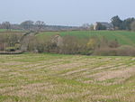
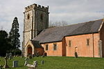
Staple Fitzpaine is a village and civil parish in Somerset, England, situated 5 miles (8.0 km) south of Taunton in the Somerset West and Taunton district. The village has a population of 189 and is within the Blackdown Hills Area of Outstanding Natural Beauty. The parish includes the hamlet of Badger Street. The parish (by area the second-largest in Somerset) stretches south to Castle Neroche, east to Whitty Cross, west to Staple Hill and north to just past Smokey Bottom. The main part of the village is centred on the crossroads by the Greyhound Inn, on the Taunton-Chard road. Curland and Bickenhall, two smaller villages close by to the east, are socially and culturally one with Staple Fitzpaine. They have a combined population of almost 200.
Excerpt from the Wikipedia article Staple Fitzpaine (License: CC BY-SA 3.0, Authors, Images).Staple Fitzpaine
Underhill Lane,
Geographical coordinates (GPS) Address Nearby Places Show on map
Geographical coordinates (GPS)
| Latitude | Longitude |
|---|---|
| N 50.9599 ° | E -3.052 ° |
Address
Underhill Lane
Underhill Lane
TA3 5BQ
England, United Kingdom
Open on Google Maps


