Staple Hill (Somerset)
Hills of SomersetMarilyns of EnglandSomerset geography stubs

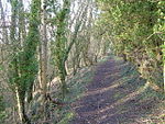
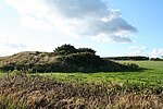
Staple Hill is a hill in the English county of Somerset, the highest point in the Blackdown Hills. It is classed as both a Marilyn and a Hardy.This is one of the points on the Staple Fitzpaine Herepath a part of Forestry England woodlands.There is a loop walk, starting from the car parking area, of 800m taking in a couple of view points with the paths upgraded early in 2009 to be suitable for disabled access.
Excerpt from the Wikipedia article Staple Hill (Somerset) (License: CC BY-SA 3.0, Authors, Images).Staple Hill (Somerset)
North Down,
Geographical coordinates (GPS) Address Nearby Places Show on map
Geographical coordinates (GPS)
| Latitude | Longitude |
|---|---|
| N 50.94381 ° | E -3.08314 ° |
Address
North Down
North Down
TA3 7EB
England, United Kingdom
Open on Google Maps


