place

Brigittenau

BrigittenauDistricts of Vienna
Kartewien20
Kartewien20

Brigittenau (German: [bʁiˌɡɪtəˈnaʊ] (listen)) is the 20th district of Vienna (German: 20. Bezirk, Brigittenau). It is located north of the central districts, north of Leopoldstadt on the same island area between the Danube and the Danube Canal. Brigittenau is a heavily populated urban area with many residential buildings.The district's name comes from the Brigitta Chapel, built between 1645 and 1651. It consists of a good tract of land secured by the regulation of the Danube 1870–75, and many of the major streets are named after members of the Danube Regulation Commission. Therefore, it does not contain any distinctive historical areas. Brigittenau was separated from the 2nd district in 1900. Earlier component districts were named Schottenau, Wolfsau, Taborau, and Zwischenbrücken. The best-known landmark is the Millennium Tower. The district also includes Adolf Hitler's former residence in Vienna, the Meldemannstraße dormitory.

Excerpt from the Wikipedia article Brigittenau (License: CC BY-SA 3.0, Authors, Images).

Brigittenau
Stromstraße, Vienna Brigittenau (Brigittenau)

Geographical coordinates (GPS) Address Website Nearby Places
placeShow on map

Wikipedia: BrigittenauContinue reading on Wikipedia

Geographical coordinates (GPS)

Latitude Longitude
N 48.236666666667 ° E 16.369444444444 °
placeShow on map

Address

Technologisches Gewerbemuseum

Stromstraße
1200 Vienna, Brigittenau (Brigittenau)
Austria
mapOpen on Google Maps

Website
tgm.ac.at

linkVisit website

Kartewien20
Kartewien20
Share experience

Nearby Places

Augarten
Augarten

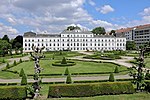
The Augarten is a public park of 52.2 hectares (129 acres) situated in the Leopoldstadt, the second district of Vienna, Austria. It contains the city's oldest Baroque park. In the north-west and north-east it borders (since 1900) on the 20th district, Brigittenau, in the north-east also on the former Nordwestbahnhof, from where the North Western Railway made its way to Bohemia, while to the south it faces the so-called Karmeliterviertel ("Carmelite quarter"), the historical Jewish quarter, followed by the Leopoldstadt. Until 1870 (Vienna Danube regulation), the areas north and east of the Augarten were floodlands mostly uninhabited. The park is designed in the French Baroque style with elaborate flower gardens and impressive shady avenues of chestnut, lime, ash, and maple. Like most fenced public parks and gardens in Vienna it is open only in the daytime: the park's five gates close at sunset (signalled by a siren). The Augarten hosts a variety of facilities such as the Wiener Sängerknaben (the Vienna Boys' Choir) in the Palais Augarten, the Augarten Porzellanmanufaktur (Augarten porcelain factory), the Augarten Contemporary (part of the Österreichische Galerie Belvedere, the Austrian Gallery housed in the Belvedere), the Filmarchiv Austria, a retirement home, a Jewish academic campus (called Lauder Chabad Campus), a paddling pool for children and sports fields. Significant testimonials to the Third Reich are two high anti-aircraft bunkers (flak towers). There are two places in the park where meals or snacks may be had, the Bunkerei (partially housed in a former bunker) and on the premises of the Filmarchiv, and in addition two catering establishments, one of them in the Atelier Augarten. The Baroque park, the palace and the remaining part of the original park wall, dating from the early 18th century, are since 2000 listed as historic monuments.