place

Frederick Law Olmsted National Historic Site

1979 establishments in MassachusettsBiographical museums in MassachusettsHistoric house museums in MassachusettsHouses on the National Register of Historic Places in Norfolk County, MassachusettsMuseums established in 1979
Museums in Brookline, MassachusettsNational Historic Landmarks in MassachusettsNational Historic Sites in MassachusettsNational Register of Historic Places in Brookline, MassachusettsProtected areas established in 1979Use mdy dates from August 2023
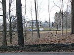
Frederick Law Olmsted National Historical Site, August 2005

Frederick Law Olmsted National Historic Site is a United States National Historic Site located in Brookline, Massachusetts, a suburb of Boston. Frederick Law Olmsted (1822–1903) is recognized as the founder of American landscape architecture and the nation's foremost parkmaker of the 19th century. In 1883, Olmsted moved his home to suburban Boston and established "Fairsted", the world's first full-scale professional office for the practice of landscape design. Over the course of the next century, his sons and successors expanded and perpetuated Olmsted's design ideals, philosophy, and influence. The site is located at 99 Warren Street, in the Green Hill section of Brookline. Olmsted bought the Clark homestead, an 1810 Federal farmhouse, in 1883, to be near his frequent collaborator, H. H. Richardson, whose home and office were nearby. Olmsted and his son John Charles renovated the house, landscaped the property, and relocated the barn closer to the house, and in 1903 added the office wing to the northwest of the main house. Members of the Olmsted family occupied the main house until 1936, when Frederick Law Olmsted Jr. moved to Elkton, Maryland, renting the house to tenants. The offices of the Olmsted Brothers firm continued to be in the wing during this time, although business also declined. Members of the firm reoccupied the house in the 1960s, making substantial alterations to the original landscaping of the property. The property was acquired by the National Park Service in 1980. The grounds have been restored to a c. 1930 appearance, restoring much of Olmsted's landscaping.Park resources include the restored "Fairsted" historic landscape, and the design office (which remains virtually unchanged from the days when the Olmsted firm's activity was at its height.) Housed within the office complex are nearly 1,000,000 original design records detailing work on many of America's most treasured landscapes, including the grounds of the U. S. Capitol and White House; Great Smoky Mountains and Acadia National Parks; Yosemite Valley; New York's Central Park; and whole park systems in cities such as Buffalo, Seattle, Boston, Louisville and Montreal. The Olmsteds also played an influential role in the creation of the National Park Service, which now owns and maintains the Olmsted site. Frederick Law Olmsted National Historic Site is open to the public. The Park Service offers guided tours of the grounds and office wing.

Excerpt from the Wikipedia article Frederick Law Olmsted National Historic Site (License: CC BY-SA 3.0, Authors, Images).

Frederick Law Olmsted National Historic Site
Fairmount Street,

Geographical coordinates (GPS) Address Nearby Places
placeShow on map

Wikipedia: Frederick Law Olmsted National Historic SiteContinue reading on Wikipedia

Geographical coordinates (GPS)

Latitude Longitude
N 42.325 ° E -71.132222222222 °
placeShow on map

Address

Fairmount Street
02447
Massachusetts, United States
mapOpen on Google Maps

Frederick Law Olmsted National Historical Site, August 2005
Share experience

Nearby Places

Reservoir Park (Massachusetts)

Reservoir Park is a historic park on Boylston Street in Brookline, Massachusetts. Its principal feature is Brookline Reservoir, formerly an element of the public water supply for neighboring Boston. The reservoir was built in 1848 as the main terminus of the now-defunct Cochituate Aqueduct, which delivered water from Lake Cochituate in the western suburbs. The reservoir covers 21.1 acres (8.5 ha), and is roughly kidney-shaped. A gravel path extends around the perimeter of the reservoir. The park is bounded on the north by Boylston Street (Massachusetts Route 9), on the west by Lee Street, on the south by Dudley Street, and on the east by Warren and Walnut Streets.There are two structures in the park. At the western end of the reservoir stands the Influent Gatehouse, the endpoint of the Cochituate Aqueduct. This is a modest utilitarian structure built out of dressed granite, about 11 feet (3.4 m) by 12 feet (3.7 m) and 11 feet in height. Its interior houses equipment for managing the flow of water from the aqueduct into the reservoir. The Principal Gatehouse, in contrast, is a more elaborate structure. It is located at the northeastern end of the reservoir, and is a two-story building partially buried in the embankment. It is built, like the Influent Gatehouse, of dressed granite, but was designed to be a public space. Its main facade has Renaissance Revival elements within a Greek-style temple front. The corners of the building have quoins in a paler shade of stone, and there is a course of that same stone in between the two floors. It has a gabled roof with a fully pedimented gable end, decorated with dentil stonework. The facade is three bays wide, with a centered entry on the lower level. The entry is recessed behind an arch that is flanked by round columns supporting an entablature. The entry is flanked by small elongated round-arch windows. The upper level consists of three larger equal-sized round-arch windows. The upper level of the building also has a facade facing the water; this also has three round-arch windows.Because the Principal Gatehouse was intended as a public space, its interior was also finished, unlike that of the Influent Gatehouse. The walls were plastered, and there were stairs, constructed of wrought iron, which were used to reach a platform giving a view of the water. These staircases are believed to the oldest surviving example of wrought iron stairs intended for public use in the United States. (They are predated by surviving stairs in lighthouses and a prison, and by public stairs in other countries.) The building's roof is also believed to be the only surviving period roof supported by wrought iron trusses.The park was listed on the National Register of Historic Places in 1985. The architectural significance of the gatehouse and its status as the best-preserved element of the Cochituate Aqueduct were recognized in its designation as a National Historic Landmark in 2015.