Leduc Formation
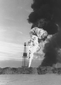
The Leduc Formation is a stratigraphic unit of Late Devonian (Frasnian) age in the Western Canada Sedimentary Basin. It takes its name from the city of Leduc, and it was formally described from the B.A. Pyrz No. 1 well in central Alberta, between the depths of 1,623.7 m (5,327 ft) and 1,807.5 m (5,930 ft), by Imperial Oil Limited in 1950. Supplementary information came from a complete section of the formation that was cored in Imperial Oil's Leduc No. 530 well between 1,633 m (5,358 ft) and 1,863 m (6,112 ft).The Leduc Formation is a major source of oil and gas in central Alberta, and the drilling of the highly successful Leduc No. 1 well in 1947 ushered in a new era in the Western Canadian petroleum industry.
Excerpt from the Wikipedia article Leduc Formation (License: CC BY-SA 3.0, Authors).Leduc Formation
Geographical coordinates (GPS) Address Nearby Places Show on map
Geographical coordinates (GPS)
| Latitude | Longitude |
|---|---|
| N 53.3451 ° | E -113.6949 ° |
Address
T9G 1Z3
Alberta, Canada
Open on Google Maps


