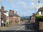
Werrington, Staffordshire

Werrington is a village in the Staffordshire Moorlands district of Staffordshire, England, about 5 miles (8 km) east of Stoke-on-Trent city centre. The village has a population of just over 3,000 people, sits at 875 feet (270 m) above sea level and is known for its windmill standing at the summit. It is surrounded by Wetley Moor, a Site of Special Scientific Interest, and has the A52 road running through the middle of the village. The village was first recorded on a map under the name of Wherington in 1749, shortly after the construction of the windmill. The windmill was in use for around 150 years, grinding corn and then coal towards the end of its working life. The village's population has grown more than tenfold since 1925, warranting its own parish council in 1988. Moorside High School and HM Prison Werrington sit within the village, as do seven listed buildings and two churches.
Excerpt from the Wikipedia article Werrington, Staffordshire (License: CC BY-SA 3.0, Authors, Images).Werrington, Staffordshire
Johnstone Avenue, Stoke-on-Trent Werrington
Geographical coordinates (GPS) Address Nearby Places Show on map
Geographical coordinates (GPS)
| Latitude | Longitude |
|---|---|
| N 53.024722222222 ° | E -2.0872222222222 ° |
Address
Werrington News
Johnstone Avenue 3
ST9 0DY Stoke-on-Trent, Werrington
England, United Kingdom
Open on Google Maps


