place

Southwest Oregon Regional Airport

Airports in Coos County, OregonNorth Bend, OregonOregon Coast
Coos County aerial
Coos County aerial

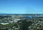
Southwest Oregon Regional Airport (IATA: OTH, ICAO: KOTH, FAA LID: OTH), formerly North Bend Municipal Airport, is a public airport in North Bend, Coos County, Oregon, United States. It is operated by the Coos County Airport District. OTH covers 619 acres (251 ha) of land.The airport changed its name in April 2006 to avoid confusion with Bend, in central Oregon. It is the only airport on the Oregon Coast with passenger service. North Bend/Coos Bay is served by United Express (SkyWest) which flies nonstop to San Francisco International Airport (since about July 2008); before the SFO flights, United Express flew OTH to Portland International Airport non-stop. This ended on February 16, 2012. United Express also has a seasonal nonstop flight to Denver. In January 2012 now defunct SeaPort Airlines began daily flights to Portland; by early 2016 SeaPort announced that they were ending their service to North Bend/Coos Bay. On the heels of the announcement by SeaPort, PenAir announced they would begin non-stop Saab 340 service between Portland and North Bend beginning March 21, 2016. SeaPort ceased operations at North Bend on March 20, 2016. The federally subsidized air service provided by PenAir proved to be short-lived and on August 4, 2017, PenAir announced the North Bend/Coos Bay service was terminated effective as of August 7, 2017.OTH had airline service on Horizon Air, direct to Portland International Airport beginning in 1982. Horizon Air ended the OTH-PDX flight on October 11, 2008. The airport is seeing more private and corporate jets bringing golfers to Bandon Dunes Golf Resort; the resort is a 20-minute drive from the OTH airport. The Coos County Airport District designed and opened a new terminal facility in July 2008; in February 2009 a new air traffic control tower opened.

Excerpt from the Wikipedia article Southwest Oregon Regional Airport (License: CC BY-SA 3.0, Authors, Images).

Southwest Oregon Regional Airport

Geographical coordinates (GPS) Address Nearby Places
placeShow on map

Wikipedia: Southwest Oregon Regional AirportContinue reading on Wikipedia

Geographical coordinates (GPS)

Latitude Longitude
N 43.417222222222 ° E -124.26277777778 °
placeShow on map

Address

Coos Bay


97420
Oregon, United States
mapOpen on Google Maps

Coos County aerial
Coos County aerial
Share experience

Nearby Places

Camp Castaway

Camp Castaway was a military encampment at what is now Coos Bay, Oregon, United States. It was established by the survivors of the wreck of the Captain Lincoln, a U.S. transport schooner, on January 3, 1852. The ship began taking on water during a storm while en route from San Francisco to Fort Orford at the town of Port Orford. To avoid sinking, the captain decided to beach the ship north of Cape Arago. All of the roughly 30 troops (U.S. 1st Dragoons, Company C, predecessors to the U.S. Cavalry) on board, and the ship's crew, survived the wreck and most of the cargo was salvaged. At the time no U.S. settlement was present at Coos Bay, so commanding officer Lt. Henry Stanton decided to establish the camp to protect the cargo until it could be transported to Fort Orford, some 50 miles south on the Oregon Coast. The troops and crew used spars, booms and sail cloth from the schooner to build tent structures for housing and for protecting the cargo from winter rains and blowing sand. They named the temporary post Camp Castaway. The camp endured for four months in the open dunes with help from Native Americans of the Coos tribe who traded fresh foods to the soldiers for silverware, biscuits and other nonlocal goods.The archaeological remains of Camp Castaway were located by archaeologist Scott Byram during a survey in March, 2010, using 150-year-old archival records and maps he studied at the United States Coast Survey archives in Maryland. It was subsequently designated Oregon archaeological site 35CS277. The site is located on land administered by the Bureau of Land Management, Coos Bay District. Following discovery of the site, BLM archaeologist Steve Samuels assembled a team from Southern Oregon University Laboratory of Anthropology, the Confederated Tribes of Coos, Lower Umpqua and Siuslaw Indians, and the Coquille Indian Tribe to excavate the site. Lead archaeologist Mark Tveskov of SOU concluded that the site was Camp Castaway based on the distinctive artifacts recovered. NOAA archaeologists Robert Schwemmer and James Delgado and historian John Cloud are also research team members. A full report of these excavations was due for publication in fall 2014.