place

Seneca, Maryland

Unincorporated communities in Montgomery County, Maryland
Seneca Schoolhouse Museum 09

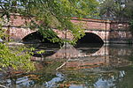
Seneca is an unincorporated community in Montgomery County, Maryland, United States. It is located near the intersection of River Road and Seneca Creek, not far from the Chesapeake and Ohio Canal (C&O Canal) and Potomac River. Its history goes back before the American Revolutionary War and it thrived when the canal was operating—having several warehouses, mills, a store, a hotel, and a school. Fighting occurred in the area on more than one occasion during the American Civil War. The community declined as the C&O Canal declined. Today (2020), the community uses a Poolesville ZIP code, but is part of the Darnestown census-designated place. The Seneca schoolhouse is a museum, and nearby Riley's Lock and lock house are part of the Chesapeake and Ohio Canal National Historical Park. The community is located near the Dierssen Wildlife Management Area and the McKee-Beshers Wildlife Management Area. Since 1978, Seneca and additional territory have been part of the Seneca Historic District.

Excerpt from the Wikipedia article Seneca, Maryland (License: CC BY-SA 3.0, Authors, Images).

Seneca, Maryland
River Road,

Geographical coordinates (GPS) Address Nearby Places
placeShow on map

Wikipedia: Seneca, MarylandContinue reading on Wikipedia

Geographical coordinates (GPS)

Latitude Longitude
N 39.078611111111 ° E -77.339166666667 °
placeShow on map

Address

River Road 15763
20874
Maryland, United States
mapOpen on Google Maps

Seneca Schoolhouse Museum 09
Share experience

Nearby Places

Seneca Quarry
Seneca Quarry

Seneca Quarry is a historic site located at Seneca, Montgomery County, Maryland. It is located along the Chesapeake and Ohio Canal on the north bank of the Potomac River, just west of Seneca Creek. The quarry was the source of stone for two Potomac River canals: the Patowmack Canal (opened in 1802, and officially known as the Great Falls Skirting Canal) on the Virginia side of Great Falls; and the C&O Canal, having supplied red sandstone for the latter for locks 9, 11, 15 - 27, and 30, the accompanying lock houses, and Aqueduct No. 1, better known as Seneca Aqueduct, constructed from 1828 to 1833. Seneca red sandstone, also known as redstone, formed during the Late Triassic age, 230 to 210 million years ago. The current geological name is Poolesville Member of Manassas Sandstone. Iron oxide gives the sandstone its rust color. It was prized for its ease of cutting, durability and bright color.The stone quarried here for the Smithsonian Castle was originally described as "lilac grey" in color when quarried," but turned rusty red as it weathered.Numerous quarries operated on the one-mile stretch of the Potomac River west of Seneca Creek. The C&O Canal provided a way for the heavy sandstone to reach the Washington, D.C. market, and the quarry's success is attributed to the canal. The Peter family of Georgetown, which built Tudor Place, owned the quarry from 1781 until 1866. John P.C. Peter, a great-grandson of Martha Washington, made the quarry into a commercial success by utilizing the C&O and winning the bid to supply red sandstone for the Smithsonian Castle, constructed 1847-1855. Peter built the stonecutting mill, drawing power from the adjacent canal turning basin. He also built a miniature of Tudor Place near the quarry called Montevideo, now owned by the Kiplinger family. Seneca Quarry provided the stone for hundreds of buildings around the Washington, DC area, including houses in the Dupont Circle and Adams Morgan area, the James Renwick Jr.-designed Trinity Episcopal Church (1849; demolished 1936), Luther Place Memorial Church (1873), and the D.C. Jail in the 1870s. Montgomery C. Meigs purchased the Government Quarry nearby for the Washington Aqueduct project in the 1850s, and that quarry provided stone for the parapet of the Union Arch Bridge, better known as the "Cabin John Bridge," the Washington Aqueduct Dam at Great Falls, McClellan Gate at Arlington National Cemetery, as well as the mile-long boundary wall that surrounds the cemetery. After the American Civil War, the Seneca Sandstone Company purchased the quarry in 1866, expanding the stonecutting mill in 1868, but went bankrupt in 1876 after financial mismanagement, sometimes referred to as the "Seneca Stone Ring Scandal." It was closed for seven years. In 1883, the Potomac Red Sandstone Company reopened the quarry but only operated until 1889, when the Great Flood of 1889 knocked out the C&O Canal for two years. Baltimore quarry operator George Mann purchased the Seneca quarry in 1891 and operated it for the next decade. By 1901, quarrying operations had stopped as the quality of the rock diminished and Victorian architecture was no longer in vogue.The Seneca Schoolhouse, a small one-room schoolhouse of red sandstone, was built in 1866 to educate the children of the stone cutters who worked at the quarry. Located in Poolesville, Maryland, it provides tours to schoolchildren so that they can experience a typical school day as it would have been on March 13, 1880.Seneca Quarry is now overgrown with sycamore trees, tulip poplars, and dense brush such as wild rose, such that it is impenetrable much of the year. It is best visited in winter. The property includes ruins of the stonecutting mill, located at "the Junction of Seneca Creek and the C&O Canal, just NW of the aqueduct" and the restored quarry master's house, located within Seneca Creek State Park. The quarry proper, Seneca Aqueduct, and the quarry cemetery are all part of the Chesapeake and Ohio Canal National Historical Park. The quarry falls within the boundaries of the Seneca Historic District. Seneca Quarry was listed on the National Register of Historic Places in 1973.

Seneca Dam

Seneca Dam was the last in a series of dams proposed on the Potomac River in the area of the Great Falls of the Potomac. Apart from small-scale dams intended to divert water for municipal use in the District of Columbia and into the Chesapeake and Ohio Canal, no version of any scheme was ever built. In most cases the proposed reservoir would have extended upriver to Harpers Ferry, West Virginia. The project was part of a program of as many as sixteen major dams in the Potomac watershed, most of which were never built. The earliest proposals for exploitation of hydropower on the Potomac were made in the 1880s. By the 1920s the U.S. Army Corps of Engineers reviewed the possibilities for hydroelectric power. After a new study mandated by Congress in 1936-37, the Corps of Engineers in 1938 proposed a dam for flood control, power generation and water quality improvement, to be located above Great Falls at Riverbend. The scheme was revived following World War II. Opposition to the flooding of the entire river to Cumberland by a chain of dams, and to the inundation of the Chesapeake and Ohio Canal doomed the Riverbend proposal. However, in 1963 the Corps proposed a new plan to improve water quality on the Potomac, which moved water storage off the main stem of the Potomac to its upper tributaries and scaled the Riverbend dam back to a lower dam at Blockhouse Point, near the mouth of Little Seneca Creek, to be called Seneca Dam. This proposal was debated through the 1960s until it was finally abandoned in 1969.

Darnestown, Maryland

Darnestown is a United States census-designated place (CDP) and an unincorporated area in Montgomery County, Maryland. The CDP is 17.70 square miles (45.8 km2) with the Potomac River as its southern border and the Muddy Branch as much of its eastern border. Seneca Creek borders portions of its north and west sides. The Travilah, North Potomac, and Germantown census-designated places are adjacent to it, as is the city of Gaithersburg. Land area for the CDP is 16.39 square miles (42.4 km2). As of the 2020 census, the Darnestown CDP had a population of 6,723, while the village of Darnestown is considerably smaller in size and population. Downtown Washington, D.C. is about 22 miles (35 km) to the southeast. Within the Darnestown census-designated place at the intersection of what is now Darnestown Road and Seneca Road, the small village of Darnestown has existed since about 1800. The community had a population of 200 in 1878. The name Darnestown comes from William Darne, who owned the most land in the area at the beginning of the 19th century when the community post office opened. Settlement in the area began around 1750, and the tiny community was called Mount Pleasant, and then Darnes, before the name Darnestown began being used. The community thrived in the 19th century during the golden years of the Chesapeake and Ohio Canal, as the improved transportation facilities offered area farmers access to more markets. In the 1880 census, the United States Census Bureau began using a Minor Civil Division (MCD) category for aggregating populations, and the new Darnestown district had about 1,500 people. Growth stopped late in the 19th century when a new railway bypassed the community. In the 1960s, affluent families began buying Montgomery County farmland for new housing and equestrian purposes. Today, many Darnestown CDP residents are wealthy and live in large homes on large lots, which is reflected in their high average income and low housing density. The median household income is nearly $228,000, and 73 percent of residents aged 25 years or more have at least a bachelor's degree or higher. The community benefits from its proximity to workplaces such as the Shady Grove Hospital area and the I-270 Technology Corridor. Washington is accessible by automobile or public transportation. Beginning with the 2000 census, the Census Bureau created a Darnestown census-designated place.