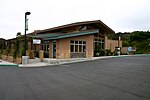
Olivenhain, Encinitas, California
Olivenhain is a neighborhood in the city of Encinitas, California, located in the North County area of San Diego County. It is the easternmost community of Encinitas, bordering the western portion of Rancho Santa Fe. The community of Olivenhain is primarily single family custom homes with relatively large lots. Minimum lot sizes range from 0.5 acres (2,000 m2) to 5 acres (20,000 m2). The topography tends to be rolling, and most streets are small and wind through the hills. Olivenhain has a vast network of recreational trails, used by walkers and equestrians. A common sight in the area during late afternoons and dusk are hot air balloons. Olivenhain has a darker sky than coastal San Diego towns due to its "Dark Sky Policy" which restricts lights from street lights, tennis courts, and other forms of light pollution.
Excerpt from the Wikipedia article Olivenhain, Encinitas, California (License: CC BY-SA 3.0, Authors).Olivenhain, Encinitas, California
Rancho Santa Fe Road,
Geographical coordinates (GPS) Address Nearby Places Show on map
Geographical coordinates (GPS)
| Latitude | Longitude |
|---|---|
| N 33.046111111111 ° | E -117.23472222222 ° |
Address
Rancho Santa Fe Road 474
92024
California, United States
Open on Google Maps


