Moel y Cerrig Duon
Gwynedd geography stubsHewitts of WalesLlanuwchllynLlanwddynMountains and hills of Gwynedd ... and 3 more
Mountains and hills of PowysMountains and hills of SnowdoniaNuttalls

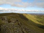
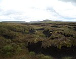
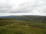
Moel y Cerrig Duon is a subsidiary summit of Esgeiriau Gwynion in Gwynedd in north Wales. Moel y Cerrig Duon tops the eastern end of a long peat bog plateau along with Llechwedd Du. Its summit has a conical shape, rising suddenly from the bog. The summit itself is grassy, marked by a small cairn and a stake. To the north-east is Foel y Geifr, to the east Cyrniau Nod and to the west is Llechwedd Du, Esgeiriau Gwynion, and Aran Fawddwy. The Aran range continues south from Moel y Cerrig Duon forming a large area of high moorland to the west of Lake Vyrnwy, crowned by Mynydd Coch. To the north it continues to Foel y Geifr, the eastern outpost of the Aran Fawddwy range.
Excerpt from the Wikipedia article Moel y Cerrig Duon (License: CC BY-SA 3.0, Authors, Images).Moel y Cerrig Duon
Geographical coordinates (GPS) Address Nearby Places Show on map
Geographical coordinates (GPS)
| Latitude | Longitude |
|---|---|
| N 52.88011 ° | E -3.38191 ° |
Address
Llanrhaeadr-ym-Mochnant
, Llanrhaeadr-ym-Mochnant
Wales, United Kingdom
Open on Google Maps


