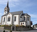
Croix de Cessange
Europe road stubsLuxembourg transport stubsRoad interchanges in LuxembourgTransport in Luxembourg City

The Croix de Cessange (Luxembourgish: Zéissenger Kräiz, German: Zessinger Kreuz) is a motorway interchange in Luxembourg City, in southern Luxembourg. It is the junction between two of Luxembourg's six motorways: the A6, on the bypass around the southwest of Luxembourg City, and the A4, which connects the city to Esch-sur-Alzette. It lies in the Cessange quarter, in the southwest of the city, hence its name.
Excerpt from the Wikipedia article Croix de Cessange (License: CC BY-SA 3.0, Authors, Images).Croix de Cessange
Autoroute d'Arlon, Luxembourg Cessange
Geographical coordinates (GPS) Address Nearby Places Show on map
Geographical coordinates (GPS)
| Latitude | Longitude |
|---|---|
| N 49.586 ° | E 6.087 ° |
Address
Autoroute d'Arlon
Autoroute d'Arlon
2548 Luxembourg, Cessange
Luxembourg
Open on Google Maps


