place

RA Centre

Buildings and structures in OttawaCurling clubs in CanadaCurling in OttawaOttawa stubsSports venues in Ottawa
Ra center ottawa
Ra center ottawa

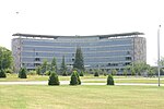
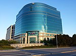
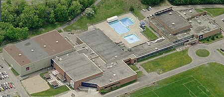
The RA Centre is a recreation and activity centre in Ottawa, Ontario, Canada. It is operated by the Recreation Association of the Public Service of Canada (more commonly known as the RA). Having been in business for over 75 years, and with a membership that exceeds 22,000, the RA is one of the largest community sport, recreation and fitness not-for-profits in the National Capital Region. The RA operates out of the RA Centre and fourteen corporate fitness centres in the region. The RA is governed by a volunteer board, and operated by a combination of paid staff and volunteers. Over fifty programs are offered, including squash, badminton, hockey, soccer and archery. The RA Centre offers a restaurant and conference rooms which can be booked for meetings or weddings.The Centre is located on Riverside Drive near the corner of Bank Street, next to Billings Bridge Plaza. It is built on the site of the brickyards of the Ottawa Brick and Terra Cotta Co. Ltd, which was bought by the Federal government in 1954 and closed in 1958.

Excerpt from the Wikipedia article RA Centre (License: CC BY-SA 3.0, Authors, Images).

RA Centre
Riverside Drive, (Old) Ottawa Capital

Geographical coordinates (GPS) Address Website External links Nearby Places
placeShow on map

Wikipedia: RA CentreContinue reading on Wikipedia

Geographical coordinates (GPS)

Latitude Longitude
N 45.382222 ° E -75.683495 °
placeShow on map

Address

R.A. Centre

Riverside Drive 2451
K1S 0X5 (Old) Ottawa, Capital
Ontario, Canada
mapOpen on Google Maps

Website
racentre.com

linkVisit website

linkWikiData (Q7275899)
linkOpenStreetMap (68586959)

Ra center ottawa
Ra center ottawa
Share experience

Nearby Places

Brewer Park Pond
Brewer Park Pond

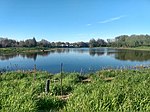
Brewer Park Pond is an artificial pond located in Brewer Park in the neighbourhood of Old Ottawa South in Ottawa, Ontario, Canada. It is connected to the Rideau River via a culvert. The pond was constructed in the early 1960s as a "swimming hole" from an area that had previously been a wetland of three small islands, known as the Bathing Islands, with channels between them in the Rideau River. The pond, which was completely separated from the river, was used for swimming until the pond was infected by bacteria and the spread of algae. The provincial health department ordered the pond's swimming facilities closed in 1971. During the 1970s, the pond was used for model yacht regattas.In the 1990s there was a large-scale community project to naturalize the area. The project, under the leadership of ECOS (the Environment Committee of the Ottawa South Community Association) saw the planting of thousands of trees and shrubs by local residents, the transformation of the hard-pack parking lot into a meadow, the construction of the pedestrian bridge between the park and Carleton University, and numerous other projects. For a number of years the pond area served as the location of Earth Day Ottawa activities. The naturalization project culminated in 2000 with a major federal government Millennium Grant to dredge a fish nursery on the river's edge, develop interpretive materials, and other undertakings.Following funding from developers Richcraft and Minto, the pond was restored in 2014 by the Rideau Valley Conservation Authority, when it was re-connected to the river via a culvert. The funding came as a result of compensation for the loss of a habitat in a new development project in Orleans. The restoration project included creating a wetland with shoreline plantings, and habitats for breeding birds, amphibians, turtle nesting beds and basking logs. The culvert allowed fish from the Rideau River to use the pond. The bottom of the pond is made of clay and organic content, and it is surrounded by a large amount of water lily tubers and grasses.Fish in the pond include yellow perch, muskellunge, northern pike, pumpkinseed, banded killifish, northern redbelly dace and bluntnose minnow. Plants in or around the pond include white water lily, water celery, pond weed, yellow water lily, bulrush, sedges, willow and silver maples. Animals include the calico pennant dragonfly, snapping turtle, wood duck, beaver, green frog, bullfrog, great blue heron, painted turtle, mudpuppy, muskrat and the red-winged blackbird.

Billings Bridge Shopping Centre

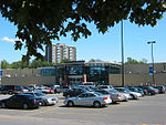
Billings Bridge Shopping Centre is a shopping mall located in the Billings Bridge neighbourhood of Ottawa, Ontario, Canada. It is a medium-sized community mall with 83 stores and services. Roughly 7.5 million people visit the mall every year and sales are about $527/sq foot. When built, it was the first strip mall in Ottawa, although it has since become an enclosed mall. It is located immediately south of the Rideau River on the corner of Bank Street and Riverside Drive. The mall's anchor stores are Walmart and Your Independent Grocer. Billings Bridge Shopping Centre opened in 1954 as "the first one-stop shopping destination to serve all of the City of Ottawa" according to its owners. At 65,750 sq ft (6,108 m2) it was Ottawa's first strip mall. The mall originally consisted of just six stores, of which only Reitmans remains to this day. CIBC and Fairweather were also very early tenants which still remain.In the years following the mall's opening, twenty stores in the mall were staying open past 6 pm on weekdays, the required time of closure by City of Ottawa by-law. As of 1956, the six units that took the municipality to court lost their appeal in court.The mall opened an expansion in November 1961, and another in March 1962, the latter bringing it to 33 stores. This made it one of Ottawa's largest shopping centres. The parking lot also expanded from 500 spots to 1400. The 1962 addition added an Ogilvy's department store, the first location in a shopping centre, Steinberg's, and a Woolworth's. A 1961 Ottawa Citizen article covering a mall expansion claimed "the new centre by its accessibility to through highways, will become not only one of the largest shopping plazas in the district but one of the finest in the country." The Ogilvy's store was rebranded as a Robinson's in 1984 after which it was replaced by discount retailer Zellers in 1996, by Target in 2013 and then by Walmart in 2016.Billings Bridge Shopping Centre was converted into an enclosed mall in 1972. A twelve-storey office tower was also added during an expansion in 1975.Billings Bridge Station opened on November 2, 1996, providing bus service via the southeast Transitway. It continues to serve as a major hub for OC Transpo bus services. In the late 1990s, a "remerchandizing program" brought in a number of new stores to replace old ones and "provide the proper tenant mix to suit this particular trade area and the shopping centre's customer base." In 1998–99, a CA$7 million renovation was carried out to add a two-storey glass atrium as a main entrance and a new food court on the second floor. In July 2006, another major renovation program was started which expanded the mall by 25,000 sq ft (2,300 m2).In 2004, Brian Card, president of Corporate Research Group said, "Billings Bridge's proximity to public transit, office buildings and growing population centres has helped it to withstand competition from big-box power centres when other shopping centres have been hard-hit." Barry Nabatian, general manager of Market Research Corporation, argued that the South Keys Shopping Centre had taken the role as 'regional mall' in the south of Ottawa, as it was larger, more popular, and had higher sales/sq foot. A 2005 article by Ottawa Business Journal said that the "lack of a major anchor department store has kept it from becoming a regional centre." Today the mall is considered a 'community' shopping centre.

Old Ottawa South
Old Ottawa South

Old Ottawa South is an older urban neighbourhood in Capital Ward in Ottawa, Ontario, Canada. Old Ottawa South is a relatively small and compact neighbourhood, located between the Rideau Canal (to the north) and the Rideau River (to the south). The eastern boundary is Avenue Road. Bronson Avenue forms the western border of the residential neighbourhood. Carleton University is on the other (western) side of Bronson but the campus can be considered to be geographically within Old Ottawa South as the campus is also nestled between the river and the canal.According to the Canada 2016 Census, the population of the neighbourhood was 6,348 Today, Old Ottawa South is an upper middle class area. Proximity to the university has meant that the neighbourhood has been a haven for professors and students, although rising housing prices are driving out the latter. It is also one of Ottawa's more politically progressive neighbourhoods and has been a stronghold for the New Democratic Party. Many neighbourhood businesses line Bank Street, including several pubs, the Mayfair Theatre, and some Lebanese stores towards the Southern end. This section of Bank Street is also well known for its antique stores. As part of a 2004 Bank Street redesign, inlaid metal maple leaves were added to the sidewalks inscribed with the names of Canadian folk musicians. Other new features included the removal of over-head powerlines, "traffic calming" measures, and the addition of more brick to the sidewalks.