place

Mooney's Bay station

2001 establishments in OntarioRailway stations in Canada opened in 2001Trillium Line stations
Mooneys station entrance

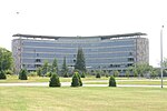
Mooney's Bay is an O-Train station along the Trillium Line located near Heron Road and Bronson Avenue in Ottawa, Ontario, which primarily serves the Government of Canada offices in the Confederation Heights area, and students from Brookfield High School. In 2011, a pedestrian and cyclist path was built to provide a direct link between Mooney's Bay Station and Brookfield Road. The station was originally named Confederation after the area in which the station is located, Confederation Heights. On December 24, 2017, the station was renamed to Mooney's Bay (after nearby Mooney's Bay Park) to avoid confusion with the O-Train's new Confederation Line, which opened in 2019.

Excerpt from the Wikipedia article Mooney's Bay station (License: CC BY-SA 3.0, Authors, Images).

Mooney's Bay station
Heron Road, (Old) Ottawa River

Geographical coordinates (GPS) Address Nearby Places
placeShow on map

Wikipedia: Mooney's Bay stationContinue reading on Wikipedia

Geographical coordinates (GPS)

Latitude Longitude
N 45.376861111111 ° E -75.684916666667 °
placeShow on map

Address

Mooney's Bay

Heron Road
K1V 6J3 (Old) Ottawa, River
Ontario, Canada
mapOpen on Google Maps

Mooneys station entrance
Share experience

Nearby Places

Brewer Park Pond
Brewer Park Pond

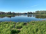
Brewer Park Pond is an artificial pond located in Brewer Park in the neighbourhood of Old Ottawa South in Ottawa, Ontario, Canada. It is connected to the Rideau River via a culvert. The pond was constructed in the early 1960s as a "swimming hole" from an area that had previously been a wetland of three small islands, known as the Bathing Islands, with channels between them in the Rideau River. The pond, which was completely separated from the river, was used for swimming until the pond was infected by bacteria and the spread of algae. The provincial health department ordered the pond's swimming facilities closed in 1971. During the 1970s, the pond was used for model yacht regattas.In the 1990s there was a large-scale community project to naturalize the area. The project, under the leadership of ECOS (the Environment Committee of the Ottawa South Community Association) saw the planting of thousands of trees and shrubs by local residents, the transformation of the hard-pack parking lot into a meadow, the construction of the pedestrian bridge between the park and Carleton University, and numerous other projects. For a number of years the pond area served as the location of Earth Day Ottawa activities. The naturalization project culminated in 2000 with a major federal government Millennium Grant to dredge a fish nursery on the river's edge, develop interpretive materials, and other undertakings.Following funding from developers Richcraft and Minto, the pond was restored in 2014 by the Rideau Valley Conservation Authority, when it was re-connected to the river via a culvert. The funding came as a result of compensation for the loss of a habitat in a new development project in Orleans. The restoration project included creating a wetland with shoreline plantings, and habitats for breeding birds, amphibians, turtle nesting beds and basking logs. The culvert allowed fish from the Rideau River to use the pond. The bottom of the pond is made of clay and organic content, and it is surrounded by a large amount of water lily tubers and grasses.Fish in the pond include yellow perch, muskellunge, northern pike, pumpkinseed, banded killifish, northern redbelly dace and bluntnose minnow. Plants in or around the pond include white water lily, water celery, pond weed, yellow water lily, bulrush, sedges, willow and silver maples. Animals include the calico pennant dragonfly, snapping turtle, wood duck, beaver, green frog, bullfrog, great blue heron, painted turtle, mudpuppy, muskrat and the red-winged blackbird.

Riverside Park, Ottawa

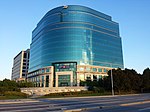
Riverside Park is a neighbourhood in the south end of Ottawa, Canada. It is bounded on the north by Brookfield Road, on the east by the Airport Parkway, on the south by the CN rail tracks and on the west by the Rideau River. The neighbourhood includes one of Ottawa's most well known beaches at Mooney's Bay and the Terry Fox Athletic Facility, along with both Vincent Massey Park, Hog's Back Park. Confederation Heights sits at the northern tip of the neighbourhood. It also includes the Ottawa Hunt and Golf Club, which has hosted professional and amateur golf tournaments. The area is served by Brookfield High School and the General Vanier, Bayview Public Schools, Georges Étienne Cartier as well as the Holy Cross Catholic School. In addition to Mooney's Bay, the area is served by four other parks; Paget Park, Marble Park, Flannery Park and Pauline Vanier Park, adjacent to General Vanier Public School. In August 2007, Bayview Public School was closed at its site on Riverside drive. Its French immersion program moved to the R. Byrns Curry Public School building (renamed Bayview Public School). R. Byrns Curry students were reassigned to General Vanier Public School (J-K to grade 3) and Fielding Drive Public School (grades 4 to 8).The neighbourhood is bifurcated by OCRR Railway. The area west of it is known as Riverside Park West and the area east of it is called Riverside Park East. The area to the south of Walkley Road is known as Riverside Park South. According to the Canada 2011 Census, the population of the neighbourhood north of Walkley (Census Tract 5050003.00) was 4564 and south of Walkley (Census Tract 5050002.01) was 2893 for a total of 7457.