Deviock
Civil parishes in Cornwall

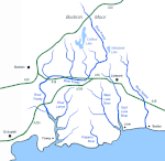
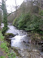
Deviock is a coastal civil parish in south-east Cornwall, England, United Kingdom. It is situated approximately three miles (5 km) west of St Germans and straddles the valley of the River Seaton. The parish includes the settlements of Hessenford, Seaton and Downderry and the population in the 2001 census was 1341, increasing to 1,420 at the 2011 census. The parish occupies an area of 2,108 hectares (approx 5,000 acres). The hamlets of Narkurs and Trelowia are also in the parish.
Excerpt from the Wikipedia article Deviock (License: CC BY-SA 3.0, Authors, Images).Deviock
B3247,
Geographical coordinates (GPS) Address Nearby Places Show on map
Geographical coordinates (GPS)
| Latitude | Longitude |
|---|---|
| N 50.391 ° | E -4.384 ° |
Address
B3247
PL11 3HL , Deviock
England, United Kingdom
Open on Google Maps


