place

Coyote Hills (Alameda County)

Alameda County, California geography stubsMountain ranges of Alameda County, CaliforniaMountain ranges of Northern CaliforniaMountain ranges of the San Francisco Bay Area
Coyote Hills (Alameda County)

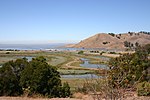
The Coyote Hills are a low mountain range in Alameda County, California.Coyote Hills Regional Park is located in and named for these hills.

Excerpt from the Wikipedia article Coyote Hills (Alameda County) (License: CC BY-SA 3.0, Authors, Images).

Coyote Hills (Alameda County)
Meadowlark Trail, Fremont

Geographical coordinates (GPS) Address Nearby Places
placeShow on map

Wikipedia: Coyote Hills (Alameda County)Continue reading on Wikipedia

Geographical coordinates (GPS)

Latitude Longitude
N 37.542158611111 ° E -122.08579638889 °
placeShow on map

Address

Police Department shooting range

Meadowlark Trail
94555 Fremont
California, United States
mapOpen on Google Maps

Coyote Hills (Alameda County)
Share experience

Nearby Places

Coyote Hills Regional Park

Coyote Hills Regional Park is a regional park encompassing nearly 978 acres of land and administered by the East Bay Regional Park District. The park, which was dedicated to public use in 1967, is located in Fremont, California, USA, on the southeast shore of the San Francisco Bay. The Coyote Hills themselves are a small range of hills at the edge of the bay; though not reaching any great height, they afford tremendous views of the bay, three of the trans-bay bridges (Dumbarton Bridge, San Mateo Bridge, and the Bay Bridge), the cities of San Francisco and Oakland, the Peninsula Range of the Santa Cruz Mountains and Mount Tamalpais. In addition to the hills themselves, the park encloses a substantial area of wetlands. There are a number of archaeological sites within the park, preserving evidence of habitation by Native Americans of the Ohlone group of tribes, including shellmounds. Access to these sites is not allowed for casual visitors, but they can be visited by arrangement. There is a substantial network of hiking trails in the park, most of them also available to equestrians, and 3.5 miles (5.6 km) to cyclists. Most of the trails are wide fireroads that go around the hills and the marshes, and one fireroad that runs north-south through the hills ridge. There are few narrow trails which are off limits to bikers and equestrians. These trails connect to others in the east bay, and the San Francisco Bay Trail passes through the park. Cross country meets for local schools are held occasionally in the park. The waters to the south and west of the park form part of the San Francisco Bay National Wildlife Refuge, and a great deal of wildlife can be seen from the park trails.

Alameda Creek
Alameda Creek

Alameda Creek (Spanish: Arroyo de la Alameda) is a large perennial stream in the San Francisco Bay Area. The creek runs for 45 miles (72 km) from a lake northeast of Packard Ridge to the eastern shore of San Francisco Bay by way of Niles Canyon and a flood control channel. Along its course, Alameda Creek provides wildlife habitat, water supply, a conduit for flood waters, opportunities for recreation, and a host of aesthetic and environmental values. The creek and three major reservoirs in the watershed are used as water supply by the San Francisco Public Utilities Commission, Alameda County Water District and Zone 7 Water Agency. Within the watershed can be found some of the highest peaks (Mount Isabel and Mount Hamilton) and tallest waterfall (Murietta Falls) in the East Bay, over a dozen regional parks, and notable natural landmarks such as the cascades at Little Yosemite and the wildflower-strewn grasslands and oak savannahs of the Sunol Regional Wilderness. After an absence of half a century, ocean-run steelhead trout are able to return to Alameda Creek to mingle with remnant rainbow trout populations. Completion of a series of dam removal and fish passage projects, along with improved stream flows for cold-water fish and planned habitat restoration, enable steelhead trout and Chinook salmon to access up to 20 miles (32 km) of spawning and rearing habitat in Alameda Creek and its tributaries. The first juvenile trout migrating downstream from the upper watershed through lower Alameda Creek toward San Francisco Bay was detected and documented in April 2023.