place

WRFN-LP

2005 establishments in TennesseeCommunity radio stations in the United StatesLow-power FM radio stations in TennesseeRadio stations established in 2005Radio stations in Nashville, Tennessee
Tennessee radio station stubs

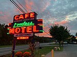
WRFN-LP is a community LPFM non-commercial radio station in Nashville, Tennessee. It operates at a frequency of 107.1 MHz and is branded as Radio Free Nashville. The station features a mix of music, talk and public affairs programming, almost all with a decidedly liberal or leftist political perspective largely not found on other area media outlets (local or national). The station went on the air in April 2005, with studios and transmitter located at the nearby community of Pasquo, Tennessee, 15 miles (24 km) west of downtown Nashville. WRFN-LP was the seventh community radio "barnraising" of the Prometheus Radio Project. In mid-2007, WRFN began simulcasting on Nashville's iQtv's second audio program (SAP). On October 25, 2009, WRFN changed its frequency to 107.1 MHz from its previously assigned frequency of 98.9 MHz, which had also been occupied by WANT in nearby Lebanon, Tennessee. A translator station, W279CH on 103.7 in Hermitage, Tennessee, signed-on in December 2014 to serve Nashville proper, expanding WRFN's over-the-air reach in the Nashville metro area. The callsign was originally used by another Nashville station, Fisk University's WFSK-FM, from its beginning in 1973 until about 1983.

Excerpt from the Wikipedia article WRFN-LP (License: CC BY-SA 3.0, Authors).

WRFN-LP
Griffith Road, Nashville-Davidson

Geographical coordinates (GPS) Address Nearby Places
placeShow on map

Wikipedia: WRFN-LPContinue reading on Wikipedia

Geographical coordinates (GPS)

Latitude Longitude
N 36.042 ° E -86.992 °
placeShow on map

Address

Griffith Road 8968
37221 Nashville-Davidson
Tennessee, United States
mapOpen on Google Maps

Share experience

Nearby Places

Bellevue, Tennessee
Bellevue, Tennessee

Bellevue is a neighborhood of Nashville, situated about 13 miles southwest of the downtown area via Interstate 40. It is served by the Metropolitan Government of Nashville and Davidson County. The 2016 population estimate for Bellevue's two main zip codes was 77,862.In the 1950s, Bellevue was a small community which existed primarily to serve the needs of nearby farms. It was mostly along the railroad tracks near the Harpeth River, and had only a few buildings such as a hardware store, post office, and a Masonic lodge hall. I-40 was built through Bellevue in the early 1960s and suburbanization of the community was made official when the United States Postal Service changed the office's designation from "Bellview, Tennessee" to a branch of the Nashville office in the late 1970s.Since the year 2000, Bellevue has grown in population and development in the established areas along Old Hickory Boulevard, Sawyer Brown Road, McCrory Lane, and Tennessee State Highway 100. Three commercial retail hotspots in the Bellevue area are near the Highway 70S/I-40 interchange, at the intersection of Highway 70S and Old Hickory Boulevard; and near the intersection of Old Harding Pike and Highway 100. Bellevue is a popular destination for nature lovers because of several attractions such as the massive Warner Parks that feature miles of paved and unpaved trails for hikers and cyclists, the Harpeth River Greenway, as well as the beginning access point for the multi-state recreational highway known as the Natchez Trace Parkway. Bellevue is the home to One Bellevue Place, a retail lifestyle center on the property formerly known as Bellevue Center Mall on Highway 70S. This shopping area includes a coffee shop, a hotel and numerous restaurants and retail establishments, anchored by a Sprouts Farmer's Market grocery store, AMC Bellevue 12 theatre, and the Bellevue Community Center and Ford Ice Center.On May 2, 2010, the Bellevue area was hard-hit by a devastating flood, but in the following decade it rebounded and experienced transformative residential and commercial development.