place

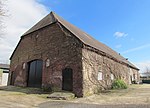
Duiven railway station

1856 establishments in the NetherlandsDuivenDutch railway station stubsRailway stations in GelderlandRailway stations in the Netherlands opened in 1856
Railway stations in the Netherlands opened in the 19th centuryRailway stations on the Rhijnspoorweg
Station Duiven
Station Duiven

Duiven is a railway station located in Duiven, Netherlands. The station was opened on 15 February 1856 and is located on the Oberhausen–Arnhem railway between Arnhem and Elten (Germany). The train services at this station are operated by Arriva and Breng. The station was closed on 4 October 1936, but reopened on 31 May 1980. ICE services pass through this station at high speed.

Excerpt from the Wikipedia article Duiven railway station (License: CC BY-SA 3.0, Authors, Images).

Duiven railway station
Parallelweg, Duiven

Geographical coordinates (GPS) Address Nearby Places
placeShow on map

Wikipedia: Duiven railway stationContinue reading on Wikipedia

Geographical coordinates (GPS)

Latitude Longitude
N 51.943333333333 ° E 6.0141666666667 °
placeShow on map

Address

Station Duiven

Parallelweg
6922 HH Duiven
Gelderland, Netherlands
mapOpen on Google Maps

Station Duiven
Station Duiven
Share experience

Nearby Places

Canal of Drusus

The Canals of Drusus (Latin: Fossae Drusianae) were Roman canals constructed for military purposes by Nero Claudius Drusus around 12 BC. It is believed to have linked the Rhine delta with the Lake Flevo, (today's IJsselmeer). They facilitated troop transport to the north, avoiding the need to cross the open North Sea. This was of strategic importance for attacks on the Germanic people living on the Frisian coasts and along the Elbe estuary in the German Bight. Drusus' son Germanicus used the canals dug by his father's army in a military campaign some decades later. The canals are mentioned by Roman historians who lived two centuries later. One of them is Suetonius, who refers to them in his Vita Divi ClaudiThe exact location of the canals is unknown, and it is a subject of debate among modern historians, archaeologists and geologists. The canals might have been located inland along the valley of the river IJssel (not yet a distributary of the Rhine branch in Roman times). Alternatively, they might have been closer to the coast in the lagoon area north of Utrecht (one of many Roman border posts), connecting lagoon lakes with local branches of the Rhine delta. Another possibility is the Lange Renne just over the border, in Germany. It connects two slings of the Rhine and has all the characteristics of a canal, including a 10-meter-deep hole in the canal bed where one of two dams was once removed, obviously created by the sudden influx of the water, and a dam on the other side of the canal that is not entirely removed.