place

Ocean Institute

Dana Point, CaliforniaEducation in Orange County, CaliforniaMaritime museums in CaliforniaMuseums in Orange County, CaliforniaNatural history museums in California
Oceanographic organizations
Tide pool2
Tide pool2

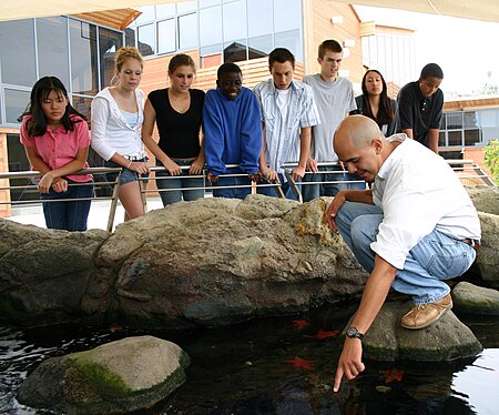
The Ocean Institute is an ocean education organization located in Dana Point, California. Founded as the Orange County Marine Institute in 1977, it offers ocean science and maritime history programs for K–12 students and their teachers. Over 100,000 students and 8,000 teachers from Orange County and the surrounding counties participate yearly in immersion-style programs in the institute's oceanfront labs and abroad.The institute is open to the general public on weekdays, 10 a.m. – 4 p.m., and weekends, 10 a.m. – 3 p.m.; visitors can see marine animals and ocean-themed exhibits. While creating the Nickelodeon animated television show SpongeBob SquarePants, biologist and cartoonist Stephen Hillenburg drew inspiration from his time teaching at the Ocean Institute.Moored at the institute is its 70-foot marine science research vessel, the R/V Sea Explorer, used for student programs and to take visitors on trips to see marine wildlife, including whale watching on weekends. The institute also partners with the Lazy-W Ranch, a camp located in the Cleveland National Forest where students study the ecosystem and California history. It provides outreach programs via a mobile laboratory provided by the "Ocean in Motion" van and distance learning via video conference.

Excerpt from the Wikipedia article Ocean Institute (License: CC BY-SA 3.0, Authors, Images).

Ocean Institute
Dana Point Harbor Drive,

Geographical coordinates (GPS) Address Nearby Places
placeShow on map

Wikipedia: Ocean InstituteContinue reading on Wikipedia

Geographical coordinates (GPS)

Latitude Longitude
N 33.4611 ° E -117.7066 °
placeShow on map

Address

Dana Point Harbor Drive 24200
92629
California, United States
mapOpen on Google Maps

Tide pool2
Tide pool2
Share experience

Nearby Places

San Juan Creek
San Juan Creek

San Juan Creek, also called the San Juan River, is a 29-mile (47 km) long stream in Orange and Riverside Counties, draining a watershed of 133.9 square miles (347 km2). Its mainstem begins in the southern Santa Ana Mountains in the Cleveland National Forest. It winds west and south through San Juan Canyon, and is joined by Arroyo Trabuco as it passes through San Juan Capistrano. It flows into the Pacific Ocean at Doheny State Beach. San Juan Canyon provides a major part of the route for California State Route 74 (the Ortega Highway). Before Spanish colonization in the 1770s, the San Juan Creek watershed was inhabited by the Acjachemen or Juañeno Native Americans. The Juañeno were named by Spanish missionaries who built Mission San Juan Capistrano on the banks of a stream they named San Juan Creek. The watershed was used mainly for agriculture and ranching until the 1950s when residential suburban development began on a large scale. Since then, the human population has continued to encroach on floodplains of local streams. Flooding in the 20th and 21st centuries has caused considerable property damage in the San Juan watershed. The San Juan watershed is home to sixteen major native plant communities and hundreds of animal species. However, the watershed is projected to be 48 percent urbanized by 2050. In addition, urban runoff has changed flow patterns in San Juan Creek and introduced pollutants to the river system. Although the main stem of San Juan Creek does not have any major water diversions or dams, some of its tributaries, including Trabuco and Oso Creeks, have been channelized or otherwise heavily modified by urbanization.