Ryall, Worcestershire
Populated places on the River SevernUse British English from July 2017Villages in WorcestershireWorcestershire geography stubs

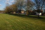
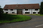
Ryall is a village in the south of Worcestershire, England, on the east bank of the River Severn, near Upton-upon-Severn on the opposite bank. The village is located on the A38 road that runs roughly parallel to the River Severn, on its Tewkesbury to Kempsey stretch, and on the A4104, which crosses the Severn at Upton. The part of the village by the A38 is called The Grove, and includes the Blue Bell public house. The part along the A4104 is called Holly Green.
Excerpt from the Wikipedia article Ryall, Worcestershire (License: CC BY-SA 3.0, Authors, Images).Ryall, Worcestershire
Strensham Road, Worcester
Geographical coordinates (GPS) Address Nearby Places Show on map
Geographical coordinates (GPS)
| Latitude | Longitude |
|---|---|
| N 52.06722 ° | E -2.19106 ° |
Address
Strensham Road
WR8 0PS Worcester
England, United Kingdom
Open on Google Maps


