East Dorset, Vermont
Census-designated places in Bennington County, VermontCensus-designated places in VermontPopulated places in Bennington County, VermontUse mdy dates from July 2023Vermont geography stubs
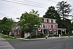
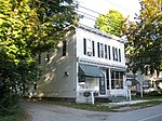
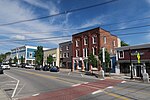
East Dorset is an unincorporated community and census-designated place (CDP) in the town of Dorset, Bennington County, Vermont, United States. It was first listed as a CDP prior to the 2020 census. It is in northern Bennington County, in the eastern part of the town of Dorset, in a valley between Mount Aeolus of the Taconic Mountains to the west and the Green Mountains to the east. The Batten Kill rises at East Dorset and flows south and west to the Hudson River in New York. U.S. Route 7 passes through East Dorset, leading north 26 miles (42 km) to Rutland and south 28 miles (45 km) to Bennington.
Excerpt from the Wikipedia article East Dorset, Vermont (License: CC BY-SA 3.0, Authors).East Dorset, Vermont
Mad Tom Road,
Geographical coordinates (GPS) Address Nearby Places Show on map
Geographical coordinates (GPS)
| Latitude | Longitude |
|---|---|
| N 43.239722222222 ° | E -73.009166666667 ° |
Address
Mad Tom Road 54
05253
Vermont, United States
Open on Google Maps


