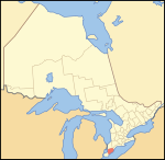
Western District, Upper Canada
1788 establishments in the Province of Quebec (1763–1791)1849 disestablishments in CanadaDistricts of Upper Canada

Western District was one of four districts of the Province of Quebec created in 1788 in the western reaches of the Montreal District which were later detached in 1791 to create the new colony of Upper Canada. Known as Hesse District (named after Hesse in Germany) until 1792, it was abolished in 1849.
Excerpt from the Wikipedia article Western District, Upper Canada (License: CC BY-SA 3.0, Authors, Images).Western District, Upper Canada
Caledonia Road, Chatham
Geographical coordinates (GPS) Address Nearby Places Show on map
Geographical coordinates (GPS)
| Latitude | Longitude |
|---|---|
| N 42.47 ° | E -82.18 ° |
Address
Caledonia Road
Caledonia Road
N7M 5J2 Chatham
Ontario, Canada
Open on Google Maps


