Chatham-Kent

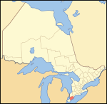
Chatham-Kent (2021 population: 104,316) is a single-tier municipality in Southwestern Ontario, Canada. It is mostly rural, and its population centres are Chatham, Wallaceburg, Tilbury, Blenheim, Ridgetown, Wheatley and Dresden. The current Municipality of Chatham-Kent was created in 1998 by the amalgamation of Blenheim, Bothwell, Camden, the City of Chatham, the Township of Chatham, Dover, Dresden, Erie Beach, Erieau, Harwich, Highgate, Howard, Orford, Raleigh, Ridgetown, Duart, Thamesville, Tilbury East, Tilbury, Wallaceburg, Wheatley and Zone. The Chatham-Kent census division, which includes the independent Delaware Nation at Moraviantown First Nation, had a population of 102,042 in the 2016 census.
Excerpt from the Wikipedia article Chatham-Kent (License: CC BY-SA 3.0, Authors, Images).Chatham-Kent
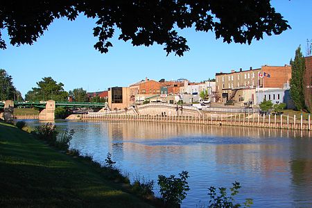
Lorne Avenue, Chatham
Geographical coordinates (GPS) Address Nearby Places Show on map
Geographical coordinates (GPS)
| Latitude | Longitude |
|---|---|
| N 42.4 ° | E -82.183333333333 ° |
Address
Lorne Avenue 37
N7M 2G6 Chatham
Ontario, Canada
Open on Google Maps


