place

Stone, Gloucestershire

Gloucestershire geography stubsStroud DistrictUse British English from March 2015Villages in Gloucestershire
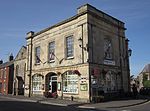
Cottage and Stone church (geograph 3160834)

Stone is a small village in the parish of Ham and Stone, Gloucestershire, England. It stands on the A38 road, just south-west of its crossing of the Little Avon River, roughly halfway between Bristol and Gloucester at grid reference ST684953. It is adjacent to the county boundary with South Gloucestershire. The part of the community just north-east of the river is called Woodford. In 2019 it had an estimated population of 527.The village of Stone has a church, a village green, a Church of England primary school and a village hall. The village also had a pub, the Berkeley Vale Hotel, but this was closed in 2013 and has been redeveloped.The village has many links with the town of Berkeley, some 2+1⁄2 miles (4 km) to the north. Also to the north lies the village of Newport.

Excerpt from the Wikipedia article Stone, Gloucestershire (License: CC BY-SA 3.0, Authors, Images).

Stone, Gloucestershire

Geographical coordinates (GPS) Address Nearby Places
placeShow on map

Wikipedia: Stone, GloucestershireContinue reading on Wikipedia

Geographical coordinates (GPS)

Latitude Longitude
N 51.656 ° E -2.458 °
placeShow on map

Address


GL13 9LB , Ham and Stone
England, United Kingdom
mapOpen on Google Maps

Cottage and Stone church (geograph 3160834)
Share experience

Nearby Places

Falfield

Falfield is a village, located near the northern border of the South Gloucestershire district of Gloucestershire, England on the southern edge of the Berkeley Vale, to the east of the River Severn and just falling into the boundary of the Cotswolds. It is the last parish on the northern boundary of South Gloucestershire. The area has a Wotton-under-Edge (GL12) post code and so is often incorrectly listed as being in the Stroud district of Gloucestershire. Falfield is one of the longest villages in England, alongside local village Cromhall. There are approximately 200 houses in the village with a population of some 500, increasing to 762 at the 2011 census. The nearest town to the village is Thornbury approximately 7 miles to the south. The nearest major cities are Bristol 16 miles to the South and Gloucester 18 miles to the North, and is often referred to as the midpoint between the two. Falfield is clustered mainly along the A38 road. It is also the first stop from Junction 14 of the M5. The shape of the parish is long in its length and narrow in its width. Both the A38 and M5 run through the village from north to south. It has a large garden centre, and two prisons (Eastwood Park and Leyhill) nearby. The village also includes St George's Church, The Huntsman Inn, a village hall, a small shop, a car dealership and several farms as well as 1st Falfield Scout Association who are celebrating their 40th anniversary in 2013 and 1st Falfield & Stone Brownies part of Girlguiding who are celebrating their 20th anniversary in 2016. Falfield St George's Church is famous for being the burial place of Conservative politician Sir George Jenkinson, who died in 1892. Politically, Falfield comes under the constituency of Thornbury & Yate, which is currently a Conservative Party seat held by Luke Hall.