place

Baldersby railway station

Disused railway stations in North YorkshireFormer North Eastern Railway (UK) stationsPages with no open date in Infobox stationRailway stations in Great Britain closed in 1959Railway stations in Great Britain opened in 1848
Use British English from April 2017Yorkshire and the Humber railway station stubs
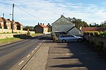
Baldersby station (remains) geograph.org.uk 1745394

Baldersby railway station was a railway station serving the village of Baldersby in North Yorkshire, England. It was located on a line from Melmerby, north of Ripon, to Thirsk on the East Coast Main Line.

Excerpt from the Wikipedia article Baldersby railway station (License: CC BY-SA 3.0, Authors, Images).

Baldersby railway station
A61,

Geographical coordinates (GPS) Address Nearby Places
placeShow on map

Wikipedia: Baldersby railway stationContinue reading on Wikipedia

Geographical coordinates (GPS)

Latitude Longitude
N 54.196747 ° E -1.460546 °
placeShow on map

Address

A61
YO7 4PS , Baldersby
England, United Kingdom
mapOpen on Google Maps

Baldersby station (remains) geograph.org.uk 1745394
Share experience

Nearby Places

Middleton Quernhow
Middleton Quernhow

Middleton Quernhow is a settlement and civil parish in North Yorkshire, England. The parish is included in the Wathvale Ward with a population of 3,479 (at the 2011 census). North Yorkshire County Council estimated that the population of the parish was 60 in 2015. It is very near the A1(M) road and is 4 miles (7 km) north of Ripon.Quernhow, which has also been spelled Whernhowe and Whernou means mill-hill, the first element deriving from the Old Norse kvern meaning a mill stone. How or Howe, deriving from the Old Norse word haugr meaning a hill, is a common element in Yorkshire place name. In this instance, the Quernhow in question is a small hillock on a road that was the dividing line between the parishes of Ainderby and Middleton Quernhow.The settlement is mentioned in the Domesday Book as being a manor of 5 carucates, once held by Tor, but by 1086 was in the possession of Count Alan. It passed through several families (de Middleton, de Scrope, best and Herbert) before the manor house was left to ruin sometime in the early 18th century. The manor house is known as The Old Hall and is now a grade II listed building but has been listed as being in poor condition and under threat and is listed on English Heritage's Buildings at Risk Register. One of the former occupants of The Old hall, Thomas Best, was a Member of Parliament for Ripon in the early 17th century.The housing in the village is mostly former estate cottages tied to the manor house. The surrounding area is grassland and is in use for arable farming.As there is no school in the village, primary school children are taken by a free bus to Pickhill Primary School on the other side of the A1(M). Secondary education for children from the area is at Thirsk School.