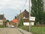
Battle of Neerwinden (1793)

The Battle of Neerwinden (18 March 1793) saw a Republican French army led by Charles François Dumouriez attack a Coalition army commanded by Prince Josias of Saxe-Coburg-Saalfeld. The Coalition army of the Habsburg monarchy together with a small contingent of allied Dutch Republic troops repulsed all French assaults after bitter fighting and Dumouriez conceded defeat, withdrawing from the field. The French position in the Austrian Netherlands swiftly collapsed, ending the threat to the Dutch Republic and allowing Austria to regain control of its lost province. The War of the First Coalition engagement was fought at Neerwinden, located 57 kilometres (35 mi) east of Brussels in present-day Belgium. After Dumouriez's victory at Jemappes in November 1792, the French armies rapidly overran most of the Austrian Netherlands. Rather than driving the Austrians to the west bank of the Rhine River, Dumouriez and the French government became preoccupied with a war with the Dutch Republic. During the breathing space offered by her enemy, Austria assembled an army under the Prince of Coburg and struck back. After a French covering force was routed by Coburg at Aldenhoven, Dumouriez began gathering his army for a counterstroke. Coburg took up a defensive position at Neerwinden and awaited the confident Dumouriez's attack. The Coalition army was outnumbered in infantry but possessed a two-to-one superiority in cavalry. After intense fighting, Coburg's troops repulsed the attacks of the French center and right wing. When Dumouriez found that his left wing was driven off the battlefield, he began retreating. The defeat led to mass desertions from the discouraged French volunteers. In the face of the military collapse, Dumouriez negotiated a free withdrawal of French troops in return for the surrender of Belgium and Dutch territory. Soon, Dumouriez was plotting against his own government and when his plans failed, he defected to the Austrians, leaving the French army in chaos.
Excerpt from the Wikipedia article Battle of Neerwinden (1793) (License: CC BY-SA 3.0, Authors, Images).Battle of Neerwinden (1793)
An der Talsperre, Bad Gottleuba-Berggießhübel
Geographical coordinates (GPS) Address Website Nearby Places Show on map
Geographical coordinates (GPS)
| Latitude | Longitude |
|---|---|
| N 50.766666666667 ° | E 5.05 ° |
Address
Landestalsperrenverwaltung des Freistaates Sachsen - Stau- und Flussmeisterei Gottleuba
An der Talsperre 1
01816 Bad Gottleuba-Berggießhübel
Sachsen, Deutschland
Open on Google Maps


