place

Nounsley

Essex geography stubsHamlets in EssexHatfield Peverel
'The Sportsmans Arms' public house, Nounsley, Essex geograph.org.uk 233205

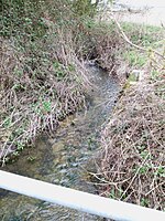
Nounsley is a hamlet in the civil parish of Hatfield Peverel, in the Braintree district, in the county of Essex, England. It is connected to the village of Hatfield Peverel by a hill and footpaths. In 2018 it had an estimated population of 681.There is one public house, The Sportsman's Arms and a ford across the River Ter. Hatfield Peverel Parish Council manage the small playing field and play area in the hamlet. The hamlet has only seven roads: Ulting Road, Sportsman Road, Nounsley Road, Manor Road, Priory Farm Road, Priory Close and Peverel Avenue. In the winter of 1962–63, snow on Nounsley Hill cut off the village to wheeled traffic for three days. The number 73 bus (provided by First) passes through the village travelling from Chelmsford to Maldon stopping at the corner of Ulting Road and Nounsley Road. The route was previously cancelled but has since 1999 been run under public subsidy.The village was home to Grace Chappelow during 1910, when she and 119 other suffragettes planned a raid on the House of Commons.The village was known as a poultry producing area, and was described in a 1972 development plan, has developed more as an isolated housing estate than a village Iron Age, Belgic and Roman pottery was found at the site of Nounsley's brickfield, which were displayed at Colchester Museum.The village has been home to a solids diverter station for the movement of sewage since 1966.

Excerpt from the Wikipedia article Nounsley (License: CC BY-SA 3.0, Authors, Images).

Nounsley
Priory Farm Road, Essex

Geographical coordinates (GPS) Address Nearby Places
placeShow on map

Wikipedia: NounsleyContinue reading on Wikipedia

Geographical coordinates (GPS)

Latitude Longitude
N 51.76424 ° E 0.60703 °
placeShow on map

Address

Priory Farm Road

Priory Farm Road
CM3 2NJ Essex, Hatfield Peverel
England, United Kingdom
mapOpen on Google Maps

'The Sportsmans Arms' public house, Nounsley, Essex geograph.org.uk 233205
Share experience

Nearby Places

Hatfield Peverel Priory

Hatfield Peverel Priory (also known as Hatfield Priory) was a Benedictine priory in Essex, England, founded as a secular college before 1087 and converted into priory as a cell of St Albans by William Peverel ante 1100. It is in the English Heritage Register of Parks and Gardens of Special Historic Interest in England and is located on the south side of the village of Hatfield Peverel, about 5 miles north-east of Chelmsford. At the Dissolution of the Monasteries, a timber-frame structure dominated the property.According to tradition the priory was founded by the Saxon Ingelrica, wife of Ranulph Peverel and reputed to be the mistress of William the Conqueror, to atone for her sins. The parish church, St Andrew's (Church of England) is the surviving fragment of the Norman priory church nave. The property was acquired by the Wright family when John Wright, a coachmaker, first landed his family in Essex in 1764. The current house, in a park designed by Richard Woods in 1765 and built in 1769, stands on a rise of land overlooking the Chelmer valley. The property passed to Wright's son, John Wright II, who died in 1796 without a male issue. The estate then passed under entail to his nephew (i.e. his sister's son) Peter Luard, who took the name and arms of Wright as required under the will. Peter (Luard) Wright, elder brother of William Wright Luard of The Lodge, Witham (and father of Admiral William Luard), occupied and expanded the property considerably. John Wright V, having suffered financial difficulties, in 1912 let the estate to Philip Charles Tennant (1867–1936), 7th son of Robert Tennant (1828-1900) of Chapel House in the parish of Conistone, Yorkshire, Member of Parliament for Leeds from 1874 to 1880. Tennant eventually purchased Hatfield Priory in 1928, following the death of the widow of John Wright V. In 1935, one year before his death, Tennant sold it to the Marianhill Mission, a Catholic lay brotherhood, which made it their European headquarters until their closure in 1972, when the property, now with derelict grounds, was purchased as a speculation by Dolph Claydon, a property developer, who quickly sold it on to Derek Marriott who used it as a school, which closed in 1979. In 2000 the property was owned by Adrian and Fiona Cowell, who have undertaken much restoration to house and grounds.

Chelmer and Blackwater Navigation

The Chelmer and Blackwater Navigation is the canalisation of the Rivers Chelmer and Blackwater in Essex, in the east of England. The navigation runs for 13.75 miles (22.13 km) from Springfield Basin in Chelmsford to the sea lock at Heybridge Basin near Maldon. Initial plans faced spirited opposition from Maldon, which were overcome by avoiding the town and terminating at Heybridge, and the navigation opened in 1797. There were some teething problems, and the engineer John Rennie was called back on two occasions to recommend improvements. The impact of the railways was less severe than on many canals, as there was never a direct line between Chelmsford and Maldon. The sea lock at Heybridge was enlarged after the Second World War, but trade gradually declined and ceased in 1972. Unlike most canals, it was not nationalised in 1948, and remained under the control of the original company. The first leisure boats to use the navigation did so in 1973, when the Inland Waterways Association organised a rally at Chelmsford. Springfield Basin was restored in 1992, but the proprietors faced bankruptcy in 2003, and after two years of negotiation, Essex Waterways Ltd, a wholly owned subsidiary of the Inland Waterways Association, took over responsibility for management, although the proprietors retained ownership. Because Essex and Suffolk Water abstract water from the navigation to supply Hanningfield Reservoir, they have a statutory obligation to maintain the outer gates at Heybridge sea lock, to prevent salt water entering the drinking water supply. They undertook major refurbishment work at the lock during the winters of 2016/17 and 2017/18, including replacement of the outer sea gate with a new design. A long-standing ambition, first proposed in 1985, has been to provide a better destination at Chelmsford, by providing access for boats to the town centre. A proposed link from Springfield Basin has been thwarted by road building in the area, but a plan to replace the automatic weir below Chelmsford Town Centre with a new structure incorporating a navigation lock was recommended in 2020.

List of local nature reserves in Essex

Essex is a county in the east of England. It is bounded by Suffolk and Cambridgeshire to the north, Hertfordshire to the west, Greater London to the south-west, Kent across the River Thames to the south, and the North Sea to the east. It has an area of 1,420 square miles (3,700 km2), with a coastline of 400 miles (640 km), and a population according to the 2011 census of 1,393,600. At the top level of local government are Essex County Council and two unitary authorities, Southend-on-Sea and Thurrock. Under the county council, there are twelve district and borough councils.Local nature reserves (LNRs) are designated by local authorities under the National Parks and Access to the Countryside Act 1949. The local authority must have legal control over the site, by owning or leasing it or having an agreement with the owner. LNRs are sites which have a special local interest either biologically or geologically, and local authorities have a duty to care for them. They can apply local bye-laws to manage and protect LNRs.As of August 2016 there are forty-nine local nature reserves in Essex. Nine are also Sites of Special Scientific Interest (SSSI), three are also scheduled monuments and four are managed by the Essex Wildlife Trust. The largest is Southend-on-Sea Foreshore with 1,084 hectares (2,680 acres), which is part of the Benfleet and Southend Marshes SSSI, an internationally important site for migrating birds. The smallest is Nazeing Triangle at 0.5 hectares (1.2 acres), which is a small pond and wildflower meadows surrounded on all three sides by roads.