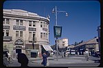
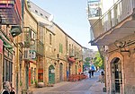
West Jerusalem

West Jerusalem or Western Jerusalem (Hebrew: מַעֲרַב יְרוּשָׁלַיִם, Ma'aráv Yerushaláyim; Arabic: القدس الغربية, al-Quds al-Ġarbiyyah) refers to the section of Jerusalem that was controlled by Israel at the end of the 1948 Arab–Israeli War. As the city was divided by the Green Line (Israel's erstwhile de facto border, established by the 1949 Armistice Agreements), West Jerusalem was formally delineated as the counterpart to East Jerusalem, which was controlled by Jordan. Though Israel has controlled the entirety of Jerusalem since the 1967 Arab–Israeli War, the boundaries of West Jerusalem and East Jerusalem remain internationally recognized as de jure due to their significance to the process of determining the status of Jerusalem, which has been among the primary points of contention in the Arab–Israeli conflict and the Israeli–Palestinian conflict. With certain exceptions, undivided Jerusalem is not internationally recognized as the sovereign territory of either Israel or the State of Palestine. However, recognition of Israeli sovereignty over only West Jerusalem is more widely accepted as a plausible diplomatic position, as the United Nations regards East Jerusalem as part of the Israeli-occupied West Bank.
Excerpt from the Wikipedia article West Jerusalem (License: CC BY-SA 3.0, Authors, Images).West Jerusalem
Zion Square, Jerusalem Nahalat Shiva
Geographical coordinates (GPS) Address Nearby Places Show on map
Geographical coordinates (GPS)
| Latitude | Longitude |
|---|---|
| N 31.781944444444 ° | E 35.219444444444 ° |
Address
כיכר ציון
Zion Square
Jerusalem, Nahalat Shiva
Jerusalem District, Israel
Open on Google Maps


