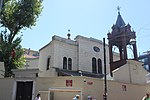
Haydarpaşa railway station

Haydarpaşa station (Turkish: Haydarpaşa Garı) is a railway station in Istanbul. Until 2012 the station was a major intercity, regional and commuter rail hub as well as the busiest railway station in Turkey. Haydarpaşa, along with Sirkeci station (on the other side of the Bosphorus), are Istanbul's two intercity and commuter railway terminals. From 19 June 2013 to 2018, all train service to the station was suspended due to the rehabilitation of the existing line for the new Marmaray commuter rail line. The station building still houses the headquarters for District 1 of the State Railways. The station building, built in 1909 by the Anatolian Railway (CFOA) as the western terminus of the Baghdad and Hedjaz railways, has become a symbol of Istanbul and Turkey and is famous throughout the Middle East.Haydarpaşa is situated on an embankment over the Bosphorus just south of the Port of Haydarpaşa and is slightly north from central Kadıköy. Until the suspension of rail service, ferry service was available to Eminönü, Karaköy and Kadıköy from the station's ferry dock. The closure of the station has been subject to a lot of controversy. As it was unclear if Haydarpaşa would be re-opened to rail service once the Marmaray project was completed. Claims that the Turkish government was planning to sell the historic railway station along with the port and turn it into a residence/luxury resort surfaced. Following the closure, a publicly formed group known as The Haydarpaşa Solidarity (Turkish: Haydarpaşa Dayanışması) staged sit-ins every week in front of the station, protesting the closure. In December 2015, the integration of Haydarpaşa station into the Marmaray network was approved along with the restoration and rehabilitation of the station building and platforms. Ever since, Haydarpaşa was placed back on official railway maps for Istanbul.
Excerpt from the Wikipedia article Haydarpaşa railway station (License: CC BY-SA 3.0, Authors, Images).Haydarpaşa railway station
Tren Garı Caddesi,
Geographical coordinates (GPS) Address Nearby Places Show on map
Geographical coordinates (GPS)
| Latitude | Longitude |
|---|---|
| N 40.996227 ° | E 29.018636 ° |
Address
Haydarpaşa Tren İstasyonu
Tren Garı Caddesi
34716
Türkiye
Open on Google Maps


