Central Waterfront, Seattle

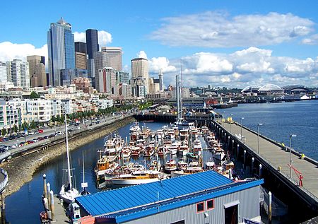
The Central Waterfront of Seattle, Washington, United States, is the most urbanized portion of the Elliott Bay shore. It runs from the Pioneer Square shore roughly northwest past Downtown Seattle and Belltown, ending at the Broad Street site of the Olympic Sculpture Park. The Central Waterfront was once the hub of Seattle's maritime activity. Since the construction of a container port to its south in the 1960s, the area has increasingly been converted to recreational and retail uses. As of 2008, several century-old piers are devoted to shops and restaurants. There are several parks, a Ferris wheel, an aquarium, and one over-water hotel. Some docks remain on the Central Waterfront, under the authority of the Port of Seattle, including a cruise ship dock, ferry terminals, and a fireboat dock. There are many architectural vestiges of the area's past status as the heart of a port, and a handful of businesses have remained in operation since that time.
Excerpt from the Wikipedia article Central Waterfront, Seattle (License: CC BY-SA 3.0, Authors, Images).Central Waterfront, Seattle
University Street, Seattle Belltown
Geographical coordinates (GPS) Address Website Nearby Places Show on map
Geographical coordinates (GPS)
| Latitude | Longitude |
|---|---|
| N 47.606388888889 ° | E -122.33972222222 ° |
Address
Cyrene
University Street 50
98101 Seattle, Belltown
Washington, United States
Open on Google Maps


