Pacific Heights, San Francisco

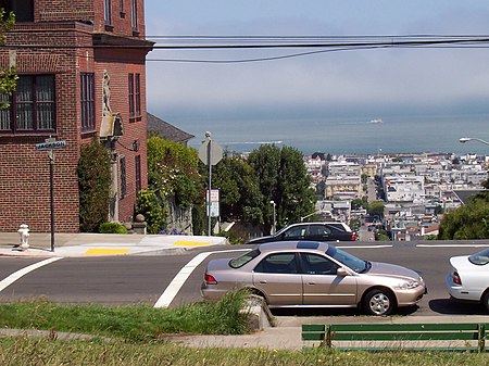
Pacific Heights is a neighborhood in San Francisco, California. It has panoramic views of the Golden Gate Bridge, San Francisco Bay, the Palace of Fine Arts, Alcatraz, and the Presidio. The Pacific Heights Residents Association defines the neighborhood as stretching from Union Street to Bush Street in the north–south direction and from Van Ness Avenue to Presidio Avenue in the east–west direction. The San Francisco Mayor's Office of Neighborhood Services defines its north–south extent more narrowly, with Green Street and California & Pine Streets serving as its boundaries.In 2013, Pacific Heights was named the most expensive neighborhood in the United States. The article stated that if San Francisco's Pacific Heights had its own zip code, it would be the most expensive place to live in the United States. The 94115 zip code includes both Pacific Heights' "Gold Coast", an area famous for its billionaire residents and record-breaking prices, and "The Western Addition", an area about 20 blocks away where real estate prices are significantly lower. In 2017, Curbed SF again announced the "occasionally chic, hardly affordable, always elite Pacific Heights" as San Francisco's most expensive neighborhood. A $40 million Pacific Heights mansion was listed as San Francisco's most expensive home. Later in the year, Business Insider gave a preview inside San Francisco's most exclusive neighborhood, where old money rubs elbows with tech billionaires. In 2018, Pacific Heights continued to garner accolades and was voted as one of the 15 most prestigious residential neighborhoods in the San Francisco Bay Area. Pacific Heights has also been listed among the top 10 richest neighborhoods in San Francisco.Pacific Heights is situated on a primarily east–west oriented ridge that rises sharply from the Marina District and Cow Hollow neighborhoods to the north to a maximum height of 370 feet (110 m) above sea level. Pacific Heights features two parks, Lafayette and Alta Plaza. Visible to the north are the Golden Gate Bridge, the Marin Headlands, and Alcatraz Island. Visible to the south are Twin Peaks and the Sutro Tower. Lower Pacific Heights refers to the area located south of California Street down to Post Street. While this area was previously considered part of the Western Addition, the new neighborhood designation became popularized by real estate agents in the early 1990s.
Excerpt from the Wikipedia article Pacific Heights, San Francisco (License: CC BY-SA 3.0, Authors, Images).Pacific Heights, San Francisco
Washington Street, San Francisco
Geographical coordinates (GPS) Address Nearby Places Show on map
Geographical coordinates (GPS)
| Latitude | Longitude |
|---|---|
| N 37.7917 ° | E -122.4356 ° |
Address
Washington Street 2566
94115 San Francisco
California, United States
Open on Google Maps


