Coral Way
Neighborhoods in Miami

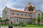
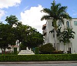
Coral Way is a neighborhood within Miami, Florida that is defined by Coral Way, a road established by Coral Gables founder George E. Merrick during the 1920s. It is located in Miami-Dade County, Florida. The Coral Way neighborhood is served by the Miami Metrorail at Vizcaya (South Dixie Highway/US 1 and West First Avenue) and Coconut Grove stations (US 1 and West 27th Avenue/SR 9).
Excerpt from the Wikipedia article Coral Way (License: CC BY-SA 3.0, Authors, Images).Coral Way
Castile Avenue,
Geographical coordinates (GPS) Address Nearby Places Show on map
Geographical coordinates (GPS)
| Latitude | Longitude |
|---|---|
| N 25.75 ° | E -80.283333333333 ° |
Address
Castile Avenue 1335
33134
Florida, United States
Open on Google Maps


