place

Ardsley railway station

1857 establishments in EnglandBeeching closures in EnglandDisused railway stations in LeedsFormer Great Northern Railway stationsPages with no open date in Infobox station
Railway stations in Great Britain closed in 1964Railway stations in Great Britain opened in 1857Use British English from June 2016
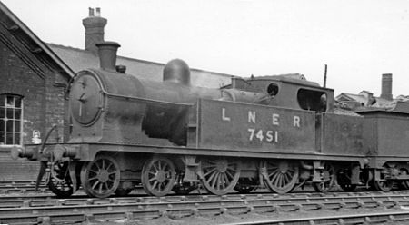
Ardsley Locomotive Depot geograph 2359946 by Ben Brooksbank

Ardsley railway station was situated on the Great Northern Railway between Tingley and Lofthouse and Outwood on the main line and west of Stanley on the LNER & LMS Methley Joint Railway. It was built to serve the village of East Ardsley near Wakefield in the English county of West Yorkshire.

Excerpt from the Wikipedia article Ardsley railway station (License: CC BY-SA 3.0, Authors, Images).

Ardsley railway station
Scampston Drive, Leeds Middleton

Geographical coordinates (GPS) Address Nearby Places
placeShow on map

Wikipedia: Ardsley railway stationContinue reading on Wikipedia

Geographical coordinates (GPS)

Latitude Longitude
N 53.7326 ° E -1.5378 °
placeShow on map

Address

Scampston Drive (Stonebridge Fold)

Scampston Drive
WF3 2FF Leeds, Middleton
England, United Kingdom
mapOpen on Google Maps

Ardsley Locomotive Depot geograph 2359946 by Ben Brooksbank
Share experience

Nearby Places

Middleton, Leeds
Middleton, Leeds

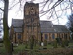
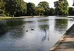
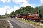
Middleton is a largely residential suburb of Leeds in West Yorkshire, England and historically a village in the West Riding of Yorkshire. It is situated on a hill 4 miles (6 km) south of Leeds city centre and 165 miles (266 km) north north-west of London. It sits in the Middleton Park ward of Leeds City Council and Leeds Central parliamentary constituency. The population of Middleton Park ward - which includes Belle Isle - was 26,228 at the 2011 Census.Middleton was occupied before the Norman Conquest and recorded in the Domesday Book of 1086 as Mildetone. It developed as a manorial estate and its owners began to exploit the coal seams that outcropped within its boundaries. At the start of the Industrial Revolution a wooden wagonway was built to link the coal pits to Leeds. The colliery agent, John Blenkinsop designed an iron railway and its first steam-powered locomotive which was built by Matthew Murray in Holbeck. The coal mines on which the local economy was based lasted until 1968 and the railway is preserved and run by a trust after operating for 200 years. Middleton Park, a remnant of the manorial estate, contains a large area of ancient woodland and parts of it, where coal was mined, are designated a scheduled ancient monument. It was the location of Middleton Hall and Middleton Lodge, homes to the local gentry. The village developed along Town Street, a school, chapel and church were built in the 19th century but after the land was acquired by Leeds Council in 1920 a large council housing estate was built on the flatter land to the south, completely changing the rural nature of the settlement. Early transport was provided by a tram line and the Leeds Ring Road was built to Middleton. After the colliery closed the area began to decline and by 2001, had areas of multiple deprivation and high levels of unemployment and anti-social behaviour. The Middleton Regeneration Board has been established with the remit of addressing these issues.